TorontoOntario · 36 tours
 Niagara FallsOntario · 25 tours
 New York CityNew York · 30 tours
 Las VegasNevada · 8 tours
 San FranciscoCalifornia · 16 tours
 VancouverBritish Columbia · 17 tours
 DubaiUAE · 54 tours
 Abu DhabiUAE · 5 tours
 Buenos AiresArgentina · 23 tours
 AthensGreece · 31 tours
 AucklandNew Zealand · 38 tours
 CancunMexico · 54 tours
No destinations match “”. Try searching all tours instead — that search understands full questions, not just place names.
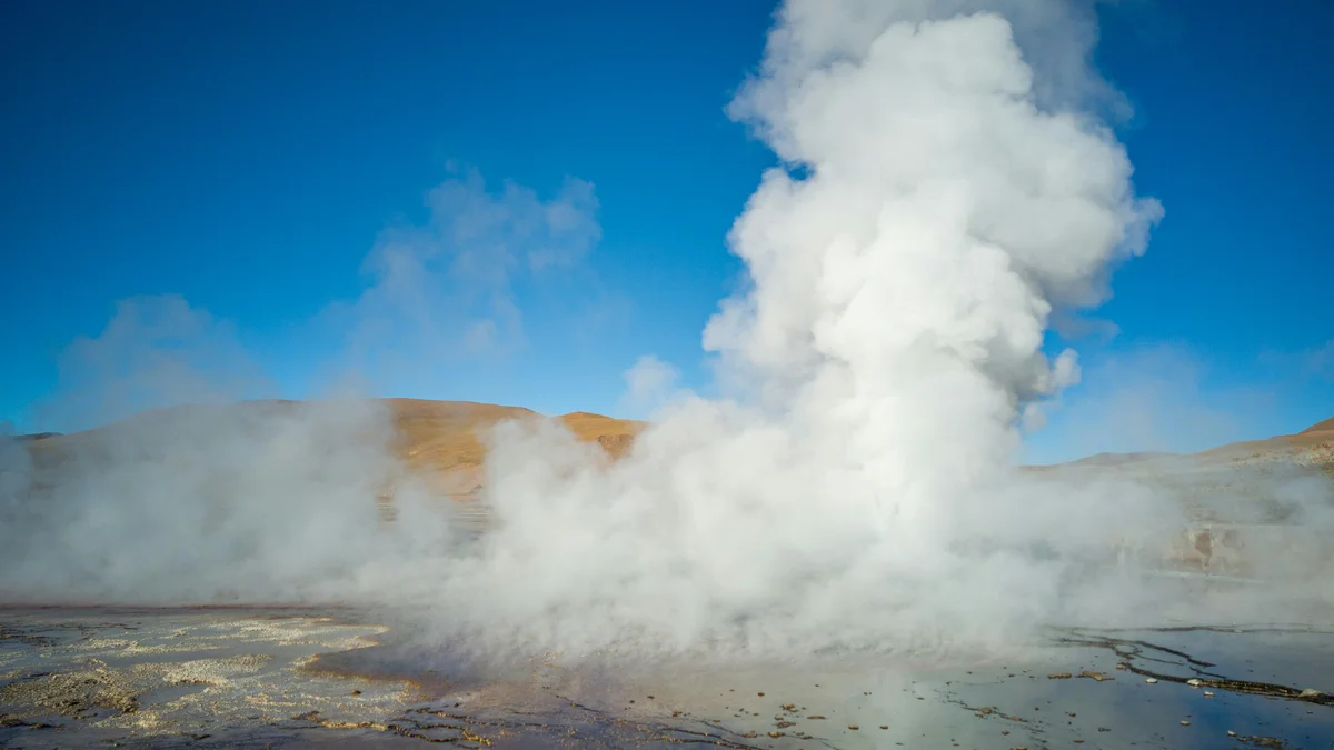
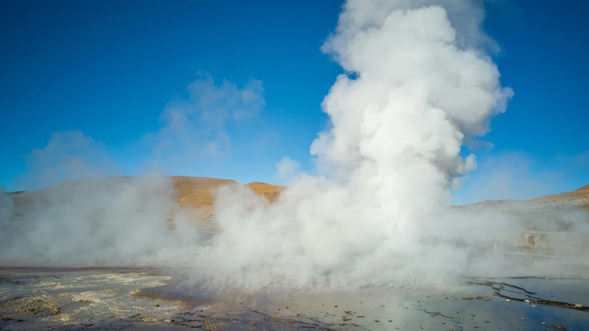
One of the world's largest and highest-altitude geyser fields, sitting at roughly 4,300 meters in the Andes north of San Pedro de Atacama. More than 80 real geysers and fumaroles are most active and visually dramatic at sunrise, when the cold morning air makes the steam plumes rise tall against the mountains.
Visitor guide
El Tatio is a geothermal field of geysers and hot springs in the Andes of northern Chile, at about 4,320 metres above sea level. Wikipedia describes it as the third-largest geyser field in the world and the largest in the Southern Hemisphere, and it is one of the main excursions from the town of San Pedro de Atacama.
El Tatio lies in the municipality of Calama, roughly 80 to 90 kilometres north of San Pedro de Atacama, near the border with Bolivia. It sits at the western foot of a line of stratovolcanoes in the Central Volcanic Zone, and the heat is thought to come from calderas of the Altiplano-Puna volcanic complex. The field contains many geysers, hot springs and mineral deposits called sinter.
The name is thought to come from the nearly extinct Kunza language, where the word tatio has been translated as oven, to appear, burnt or, in one reading, grandfather, whose tears are said in local tradition to form the geysers. The field is also known as the Copacoya geysers after a nearby mountain. An old Inca trail crossed the field.
The water appears to originate as precipitation that falls to the east and southeast and takes either 15 years or more than 60 to travel underground to the springs, according to Wikipedia. The geothermal vents host extremophile microorganisms, and El Tatio has been studied as an analogue for the early Earth and possible past life on Mars. Water from the springs flows into the Rio Salado, which has increased arsenic levels.
Wikipedia reports that around 100,000 people visit each year and that the indigenous communities of Toconce and Caspana administer the site. Besides watching the geysers, activities include bathing in warm water and visiting nearby Atacameno villages with adobe buildings. Environmental impacts such as pollution and damage to geothermal landforms have been documented, so visitors are asked to stay on marked paths.
The field was prospected for geothermal power over the last century, with the first surveys in the 1920s and more systematic research between 1967 and 1982. Development efforts were discontinued after a major incident in 2009 in which a geothermal well blew out, creating a steam column. Wikipedia says the blowout caused a political controversy about geothermal power development in Chile.
Wikipedia also records that in 2002 the area was declared a zone of touristic interest, which implies that local institutions should develop an action plan for tourism.
Wikipedia highlights the usual hazards of geothermal areas: hot gases and water can cause burns, and fragile crust may conceal boiling water. The altitude can also trigger altitude sickness, and the climate is cold and dry. The Chilean government recommends warm clothing, sunscreen and mineral water.
Visits are commonly organised as early excursions from San Pedro de Atacama. A private guided visit with a dedicated vehicle and driver lets a group move at its own pace and receive local explanation of the field.
See every tour and attraction we cover in San Pedro de Atacama.