TorontoOntario · 36 tours
 Niagara FallsOntario · 25 tours
 New York CityNew York · 30 tours
 Las VegasNevada · 8 tours
 San FranciscoCalifornia · 16 tours
 VancouverBritish Columbia · 17 tours
 DubaiUAE · 54 tours
 Abu DhabiUAE · 5 tours
 Buenos AiresArgentina · 23 tours
 AthensGreece · 31 tours
 AucklandNew Zealand · 38 tours
 CancunMexico · 54 tours
No destinations match “”. Try searching all tours instead — that search understands full questions, not just place names.
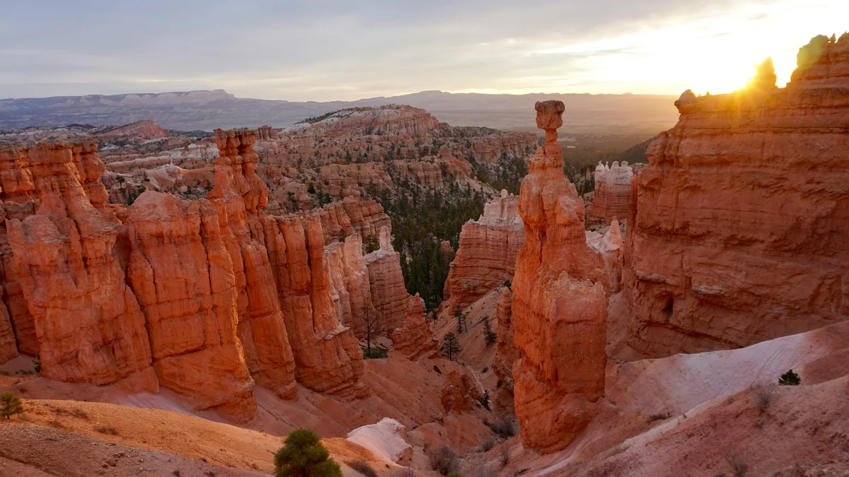
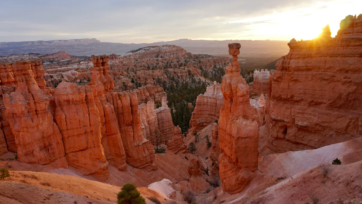
Sunrise Point is one of the most popular overlooks in Bryce Amphitheater, giving a wide view across Bryce Canyon National Park's dense field of hoodoos — the spindly, colorful rock columns the park is known for. As its name suggests, it's a favored spot to watch dawn light hit the amphitheater, when the hoodoos take on deep orange and pink tones. It also marks one end of the Queen's Garden Trail, one of the easier hikes that actually descends among the hoodoos rather than viewing them from the rim.
Visitor guide
Sunrise Point is the northernmost of the four major viewpoints on the rim of the Bryce Amphitheater in Bryce Canyon National Park, Utah. The National Park Service puts its elevation at about 8,100 feet (2,469 m), and it is one of the park's early viewpoints, named to give visitors to the original lodge easy rim access at sunrise and sunset.
The view looks over the amphitheater's hoodoos, the rock spires for which the park is known. Below the rim, Bristlecone Point is a crown-shaped feature in the amphitheater's center capped by white Claron Formation layers where bristlecone pines grow, and Stilts is a limber pine whose roots have been exposed by erosion. To the northeast, Boat Mesa and the tilted slope of the Sinking Ship stand against the Pink Cliffs of the Table Cliff Plateau, about 17.5 miles away. To the east, the colorful badlands and broad Paria Valley stretch toward Navajo Mountain on the southeastern horizon. The NPS also notes a 360-degree view that is good for stargazing and for watching the final light in the west.
The rock is the Claron Formation, laid down some 50 to 60 million years ago in a system of lakes, with white and pink members made largely of limestone mixed with silt and clay. The NPS explains that as the plateau rim erodes back it exposes fins; meltwater seeps into the cracks and refreezes, and frost wedging breaks the fins into windows and eventually isolated columns. Rain also dissolves the calcium carbonate that holds the rock together. The park notes freeze-thaw temperatures on more than 170 nights a year, and the rim erodes by roughly one to four feet per century. Park scientists have noted that the frost-wedging explanation has not been tested in peer-reviewed research, so it is the leading explanation rather than a settled one.
The Paunsaugunt fault runs roughly north-south along the park's eastern edge and accounts for about 2,000 feet of elevation difference between the amphitheater and the Table Cliff Plateau. The Sinking Ship's tilt results from being partly caught on this fault, and the Paria River carved the valley beyond over roughly the last 6 million years.
Sunrise Point is the trailhead for the Queen's Garden Trail, the least strenuous of the trails descending into the amphitheater, at 1.8 miles round trip with about 450 feet of elevation gain and one to two hours. A short spur leads to a hoodoo said to resemble Queen Victoria, and the trail passes bristlecone pines. The NPS calls the Queen's/Navajo Combination Loop, about 2.9 miles round trip, the park's most popular hike; it returns along a flat half-mile of the Rim Trail between Sunset and Sunrise Points. That paved stretch of the 5.5-mile Rim Trail is the park's easiest walk. The trailhead is listed on the National Register of Historic Places as part of the Scenic Trails Historic District (1995).
Sunrise and sunset are the classic times here, and a private Voyzo tour with door-to-door pickup lets you time your stop for the light without managing a rental car. Check the NPS for current shuttle, parking and trail conditions, and note that trail conditions can be hazardous in ice or heat.
See every tour and attraction we cover in Bryce Canyon National Park.