TorontoOntario · 36 tours
 Niagara FallsOntario · 25 tours
 New York CityNew York · 30 tours
 Las VegasNevada · 8 tours
 San FranciscoCalifornia · 16 tours
 VancouverBritish Columbia · 17 tours
 DubaiUAE · 54 tours
 Abu DhabiUAE · 5 tours
 Buenos AiresArgentina · 23 tours
 AthensGreece · 31 tours
 AucklandNew Zealand · 38 tours
 CancunMexico · 54 tours
No destinations match “”. Try searching all tours instead — that search understands full questions, not just place names.
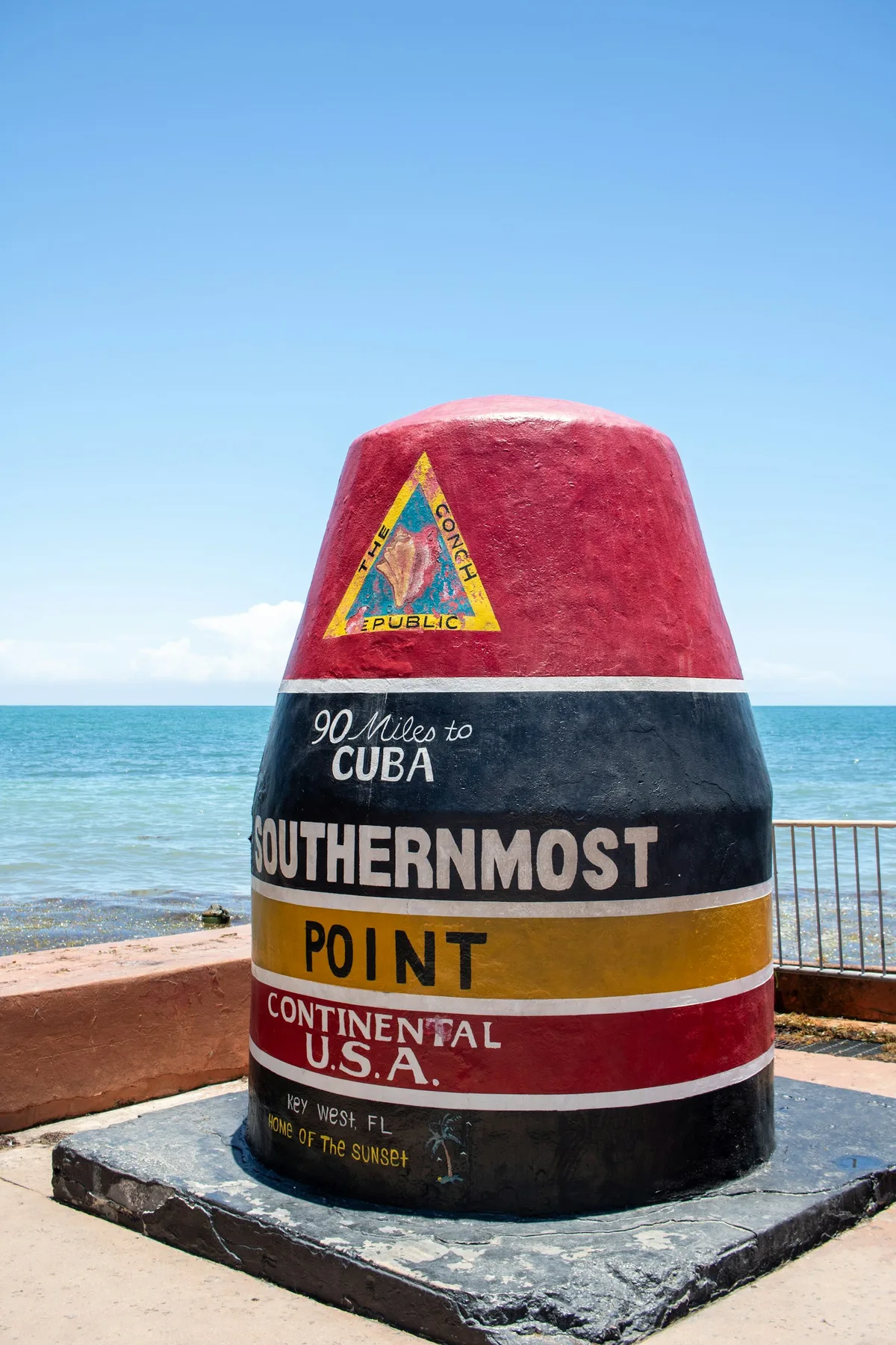
The famous red, black, and yellow concrete buoy marking the southernmost point in the continental United States, reading "90 Miles to Cuba" — one of the most photographed spots in Key West.
Visitor guide
The Southernmost Point Buoy is a painted concrete marker at the corner of South and Whitehead Streets on the southern shore of Key West. It is one of the most photographed spots in the Florida Keys, and it is celebrated as the southernmost point of the continental United States that a visitor can easily reach, which is a more careful claim than it first appears.
Before the buoy, the corner had a modest wooden sign. A 1970 version described the spot as the southernmost point of the southernmost city, and by 1982 the wording had grown to claim the southernmost point in the USA. A separate sign pointed south toward Cuba. The city and then-mayor Dennis Wardlow dedicated the concrete buoy on September 10, 1983, and according to the City of Key West, local artists Henry Del Valle and Danny Acosta painted it and repainted it after Hurricane Irma. The Key West Public Works Department looks after it.
The corner has older connections to Cuba too. A telephone cable laid in 1921 linked Key West to Havana, and a small cement hut beside the marker housed the cable equipment. The buoy has been repainted and refurbished several times, so its exact lettering has changed over the decades. In its recent form it reads "The Conch Republic," "90 Miles to Cuba," "Southernmost Point Continental U.S.A.," and "Home of the Sunset."
Not quite, and Key West locals will tell you so cheerfully. The beach at Fort Zachary Taylor extends roughly 500 feet farther south than the marker, and the southernmost land on the island itself lies on the former Truman Annex naval property, about 900 feet beyond the buoy, where there is no marker and civilians cannot go. The southernmost point of land in the contiguous United States is generally given as Ballast Key, an island about 9 to 10 miles west of Key West that sits within the Key West National Wildlife Refuge. So the buoy is best understood as the southernmost point of the continental US that is marked and open to the public, rather than the literal geographic extreme.
The "90 Miles to Cuba" line is a rounded figure. The nearest point of Cuba is about 94 statute miles (82 nautical miles) due south, and one author has suggested that 90 refers to nautical miles from Key West to Havana. Either way, it is a nice reminder of how close the island sits to the Straits of Florida's far shore.
The buoy itself stands roughly 12 feet tall according to the reference listing, though other descriptions give a higher figure that may include its base, so treat any single number loosely. The photograph is the point: red, black and yellow bands, the Cuba mileage and the Gulf-meets-Atlantic backdrop. The corner draws a queue at busy times, and a webcam watches the intersection.
In September 2025 the city installed a duplicate concrete buoy at the end of nearby Duval Street while seawall repairs were under way at Whitehead and Duval Streets, and the original was reported to be covered during the work. Arrangements at the site may have changed since, so check with the City of Key West for the current status of the original buoy and the photo area before you plan around it.
Fort Zachary Taylor Historic State Park and its beach lie just west along the shore, the southern end of Duval Street is a block away, and Mallory Square is a straight walk north across Old Town for the sunset.
See every tour and attraction we cover in Key West.