TorontoOntario · 36 tours
 Niagara FallsOntario · 25 tours
 New York CityNew York · 30 tours
 Las VegasNevada · 8 tours
 San FranciscoCalifornia · 16 tours
 VancouverBritish Columbia · 17 tours
 DubaiUAE · 54 tours
 Abu DhabiUAE · 5 tours
 Buenos AiresArgentina · 23 tours
 AthensGreece · 31 tours
 AucklandNew Zealand · 38 tours
 CancunMexico · 54 tours
No destinations match “”. Try searching all tours instead — that search understands full questions, not just place names.
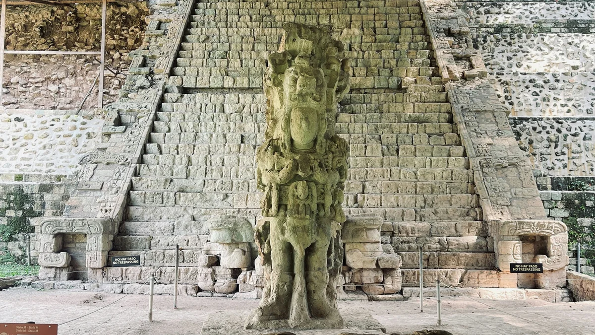
Honduras's single most famous landmark and a UNESCO World Heritage Site, this ancient Maya city near the Guatemala border is renowned for its intricately carved stelae, the Hieroglyphic Stairway, and a well-preserved ballcourt, once a major center of Maya art and astronomy in the 7th century.
Visitor guide
Copán is an archaeological site of the Maya civilization in the Copán Department of western Honduras, not far from the Guatemalan border. It was the capital of a major Classic-period kingdom and is known for its sculpted portrait stelae, the Hieroglyphic Stairway and a large ballcourt. UNESCO inscribed the site as a World Heritage Site in 1980.
The ancient city sits in the fertile alluvial basin of the Copán River, at roughly 600 to 700 metres above sea level according to Wikipedia. Its position at the southeastern edge of Mesoamerica made it a bridge between the lowland Maya cities to the north and the non-Maya peoples of southern Central America. The kingdom is also described as controlling access to the upper Motagua River valley, a source of jadeite and obsidian. The ancient name of the city is thought to have been Oxwitik, meaning the “Three Witiks.”
The valley was farmed long before the city's golden age, but the royal dynasty dates from AD 426, when a ruler known as K'inich Yax K'uk' Mo' was installed on the throne. Hieroglyphic texts and later monuments link him to Tikal, and he is depicted on Altar Q in the guise of a warrior with Teotihuacan-style imagery. The dynasty he founded ruled for about four centuries and included sixteen kings.
One of the best-known episodes in Copán's history is the death of its long-ruling king Uaxaclajuun Ub'aah K'awiil, who was captured and executed in AD 738 by the ruler of Quiriguá, a city that had once been a vassal. The defeat disrupted trade and royal prestige, and Copán may have been subject to Quiriguá for a time. Within a few decades, however, rulers resumed major building projects, and the later king Yax Pasaj Chan Yopaat completed the final version of Temple 16 around AD 776.
The last known king, Ukit Took', took the throne in AD 822. He ordered Altar L, which was left unfinished, with only one face carved. Sources describe a valley under heavy pressure from population, shortage and disease by this time, and the city was largely abandoned in the early 10th century. Spanish writers first mentioned the ruins in a letter of 1576, and later visitors including Juan Galindo, John Lloyd Stephens and Frederick Catherwood, and Alfred Maudslay helped make the site known to the wider world.
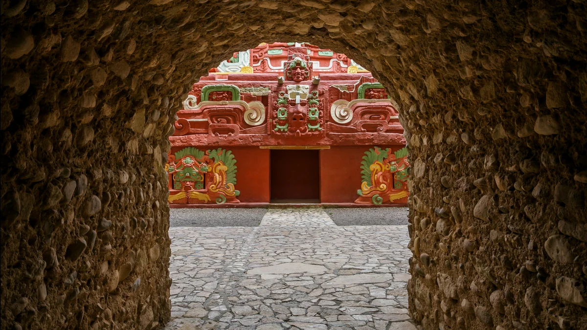
The Main Group is the ceremonial core of the city and covers an area of about 600 by 300 metres. On its south side rises the Acropolis, a royal complex of overlapping pyramids, courts and palaces. Archaeologists have dug extensive tunnels beneath it, revealing earlier building phases, including the remarkably well-preserved Rosalila temple, whose painted stucco decoration survives from base to roof comb. Altar Q, set at the foot of Temple 16, shows the sixteen rulers of the dynasty in sequence.
The Hieroglyphic Stairway climbs the west side of Structure 10L-26 and has 62 steps. A sculpted seated figure sits at the centre of every twelfth step, and the risers carry well over 1,800 glyphs (UNESCO's figure; other sources say about 2,200) that form what UNESCO describes as the longest inscribed text in the Maya region. Because the facade collapsed, the blocks were scrambled and scholars are still reconstructing the sequence. Nearby, the ballcourt was dedicated to the great macaw deity and carried sixteen macaw mosaic sculptures, with its completion date inscribed as 6 January 738. The Monument Plaza holds the greatest concentration of sculpted stelae at the site.
The Copán River gradually changed course after the city was abandoned and cut away much of the eastern Acropolis, exposing a vertical cross-section about 37 metres high and 300 metres long. In the 20th century the river was redirected to protect the remaining structures. Heritage listing came in 1980 from UNESCO and in 1982 from the Honduran government as a cultural monument.
The ruins lie about 1.6 kilometres from the town of Copán Ruinas, which serves as the usual base for visitors. With so many carved monuments, glyph texts and tunnelled phases, a private guided visit with a knowledgeable local guide suits the site well, since the meaning of the sculpture is easiest to follow with someone explaining the dynastic story.
See every tour and attraction we cover in Honduras.