TorontoOntario · 36 tours
 Niagara FallsOntario · 25 tours
 New York CityNew York · 30 tours
 Las VegasNevada · 8 tours
 San FranciscoCalifornia · 16 tours
 VancouverBritish Columbia · 17 tours
 DubaiUAE · 54 tours
 Abu DhabiUAE · 5 tours
 Buenos AiresArgentina · 23 tours
 AthensGreece · 31 tours
 AucklandNew Zealand · 38 tours
 CancunMexico · 54 tours
No destinations match “”. Try searching all tours instead — that search understands full questions, not just place names.
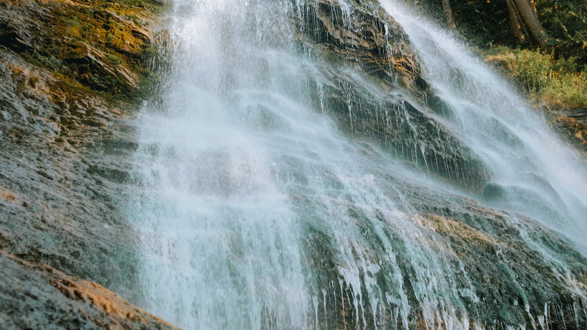
A short forest trail leads to a 60-metre waterfall cascading down a rock face just off the Trans-Canada Highway near Chilliwack, one of the most accessible dramatic waterfalls in the Fraser Valley.
Visitor guide
Bridal Veil Falls Provincial Park is a small day-use park on the Trans-Canada Highway near Popkum, in the Fraser Valley east of Chilliwack, British Columbia. A short walk through forest leads to a viewing platform near the falls.
BC Parks says the falls drop 60 metres over a smooth rock face. Wikipedia gives a total height of about 122 metres and a width of about 23 metres in a segmented, tiered form, noting only the bottom 200 to 250 feet is clearly visible from the base viewing points. These figures disagree, so treat any height as approximate. Wikipedia also warns that the common claim that it is the fourth tallest waterfall in Canada is not supported (it ranks the falls 38th in British Columbia), and one tourism site calls it sixth-highest, so no national ranking is given here.
Wikipedia says the falls originate on Mount Archibald, while a tourism listing places them at the base of Mount Cheam; sources differ on which peak to name. Water flows down Bridal Creek, passes under the highway and reaches Cheam Lake Wetlands Regional Park before joining the Fraser River. Flow drops in dry summers, which lessens the effect.
BC Parks describes the site as the location of Popkum, an ancient village with settlement records from the 1700s. The name comes from a First Nations word for the puffball, a fungus that grows abundantly in the area, per BC Parks. Popkum First Nation, a Stó:lō band government, is based in the area, and BC Parks notes its own page may not fully reflect the Indigenous history of the land.
In the early 1900s the falls powered a generator that supplied the Bridal Falls Chalet; Wikipedia adds that the electricity also heated a swimming pool, and only traces of the concrete foundation remain. The site became a provincial park in 1965.
The nearby community was originally going to be called Bridal Veil Falls, but BC Geographical Names records that the post office asked for that name and had to take Bridal Falls instead because another Canadian post office already used it; the post office opened on 1 November 1937. Julius Warneboldt built the Bridal Falls Lodge there in the mid-1930s, according to the Encyclopedia of British Columbia.
The park lies in the Coastal Western Hemlock zone, with a dense canopy of western red cedar, hemlock, broadleaf maple and red alder over a sparse understory of western sword fern and spiny wood ferns. BC Parks lists songbirds and small mammals as the main residents, with porcupine, Columbia black-tailed deer and black bear also seen. Visitors are asked to stay on the trails to protect the plants and soil.
Songbirds named by BC Parks and the provincial tourism site include the varied thrush, black-throated gray warbler and red-breasted nuthatch. The tourism site gives the park's size as 32 hectares. The forest is shaded and often damp, so footing on the trail can be slick after rain.
BC Parks describes a loop trail to the viewing platform of about half an hour return, from exit 135 on Highway 1, about 16 kilometres east of Chilliwack; other sources say 15 to 25 minutes each way. Pets must be leashed and kept out of beach areas and buildings. In cold winters the falls can form an unstable ice wall, making the base hazardous from slippery footing and falling ice or rock; Wikipedia adds that the frozen falls attract ice climbers when conditions allow, and that the park closes for winter. Check BC Parks for current access and conditions.
Voyzo's private vehicle and driver can collect your group at your door and combine the falls with other Fraser Valley stops, which is convenient since the walk is short.
See every tour and attraction we cover in Fraser Valley.