TorontoOntario · 36 tours
 Niagara FallsOntario · 25 tours
 New York CityNew York · 30 tours
 Las VegasNevada · 8 tours
 San FranciscoCalifornia · 16 tours
 VancouverBritish Columbia · 17 tours
 DubaiUAE · 54 tours
 Abu DhabiUAE · 5 tours
 Buenos AiresArgentina · 23 tours
 AthensGreece · 31 tours
 AucklandNew Zealand · 38 tours
 CancunMexico · 54 tours
No destinations match “”. Try searching all tours instead — that search understands full questions, not just place names.
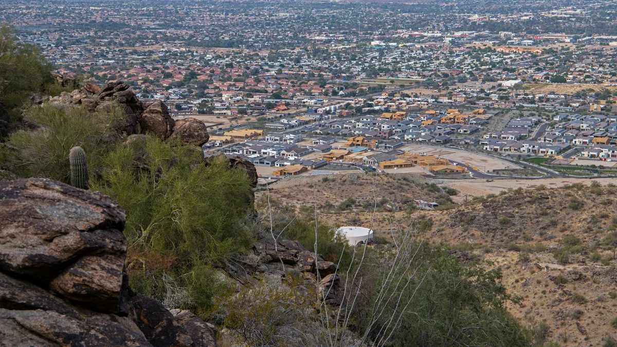
One of the largest municipal parks in the United States, spanning roughly 16,000 acres with more than 100 miles of trails, according to the City of Phoenix. The Dobbins Lookout viewpoint offers sweeping panoramic views over the Valley of the Sun, making it a favorite for hiking, mountain biking, and horseback riding.
Visitor guide
South Mountain Park and Preserve is a large desert mountain park just south of downtown Phoenix, managed by the City of Phoenix. The city describes it as one of the largest municipally managed parks in the country, covering more than 16,000 acres of Sonoran Desert ridgeline, canyon and trail. Its best-known viewpoint, Dobbins Lookout, rises to 2,330 feet and looks out over the whole Valley of the Sun.
The mountains were once known as the Salt River Mountains. In 1924 President Calvin Coolidge sold an initial tract to the city for what was then called Phoenix Mountain Park; Wikipedia and the city give 13,000 acres for $17,000, though a contemporary newspaper headline referred to a 14,000-acre plan, so figures vary. Phoenix marked the park's 100th anniversary in 2024. The early park committee was led by J.C. Dobbins, chairman of the city planning commission, with Mrs. John Hampton and H.B. Wilkinson, and Dobbins Lookout carries his name. Bond programs in the 1970s and early 1980s later enlarged the park to its present size.
The Civilian Conservation Corps shaped much of what visitors use today. Living New Deal records say the CCC developed the park for recreation from 1933 to 1940, from two camps, and built trails, the summit road, and the large stone shelter at Dobbins Lookout, which is considered the park's symbol. A 1935 master plan called for riding and hiking trails, picnic areas and overlooks.
The park comprises three ranges, the Ma Ha Tauk, Gila and Guadalupe mountains. The vegetation is classic upper Sonoran Desert, with saguaro, palo verde and ironwood on the slopes, and the elephant tree, a rare species with twisted trunks, is a notable plant here. Researchers have also documented an unusually dense population of chuckwalla lizards in the park. Hohokam rock art survives in parts of the preserve; the city notes it, and visitors should look but not touch.
Dobbins Lookout is reachable both by hiking trails and by Summit Road, and the stone shelter and surrounding viewpoints give wide views of the Phoenix skyline and surrounding ranges. Trail mileage figures differ by source, from roughly 58 miles in some references to more than 100 miles on the city's own page, and the network serves hikers, mountain bikers and horseback riders. The Maricopa Trail and Sun Circle Trails pass through. The park has scenic drives, ramadas and a visitor center. In the foothills nearby is Mystery Castle, a quirky hand-built landmark.
Summit Road has blind corners and drop-offs, and the city asks drivers to take it slowly. The city runs periodic "Silent Sunday" road closures reserved for non-motorized use, and trails and roads occasionally close for projects, so check the City of Phoenix Parks and Recreation site for current access. Carry water and avoid midday summer heat; sunrise and sunset visits are the most comfortable and photogenic.
A Voyzo private tour can include a drive up to Dobbins Lookout: with a private vehicle and driver and door-to-door pickup, you can enjoy the viewpoints without handling the narrow summit road yourself.
See every tour and attraction we cover in Phoenix.