TorontoOntario · 36 tours
 Niagara FallsOntario · 25 tours
 New York CityNew York · 30 tours
 Las VegasNevada · 8 tours
 San FranciscoCalifornia · 16 tours
 VancouverBritish Columbia · 17 tours
 DubaiUAE · 54 tours
 Abu DhabiUAE · 5 tours
 Buenos AiresArgentina · 23 tours
 AthensGreece · 31 tours
 AucklandNew Zealand · 38 tours
 CancunMexico · 54 tours
No destinations match “”. Try searching all tours instead — that search understands full questions, not just place names.
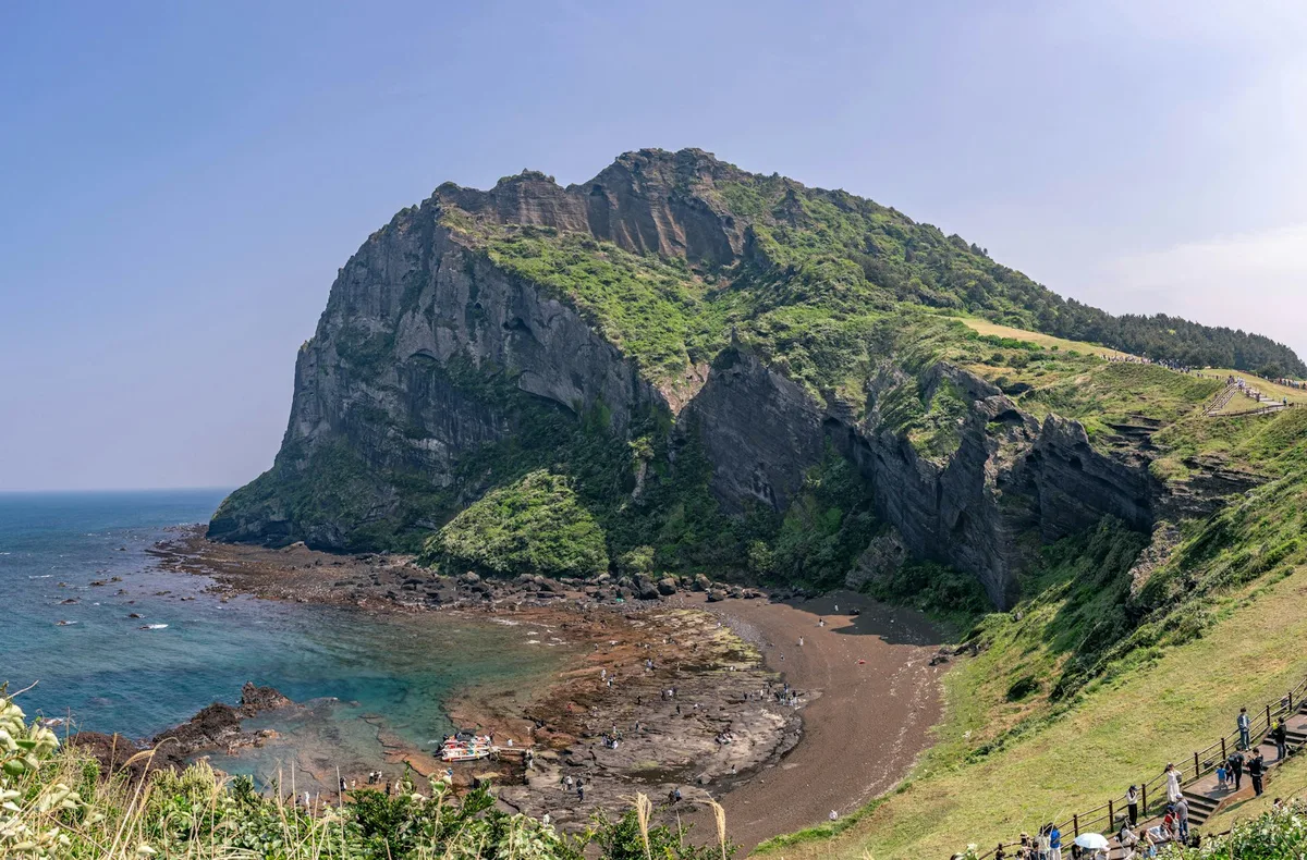
A UNESCO-listed tuff cone that rises straight out of the sea on Jeju's east coast, formed by a volcanic eruption roughly 5,000 years ago.
Visitor guide
Seongsan Ilchulbong, also called Sunrise Peak, is a volcanic tuff cone on the eastern coast of Jeju Island, South Korea, in Seongsan-ri, Seogwipo. It rises about 182 metres and has a grassy bowl-shaped crater at its summit. It is part of the UNESCO World Heritage serial property Jeju Volcanic Island and Lava Tubes.
Seongsan means fortress mountain, because the cone is said to resemble a Korean fortress, and Ilchulbong means sunrise peak, a name reportedly used since ancient times. According to Wikipedia, it was formerly called Cheongsan, meaning green or blue mountain. The mountain is about 600 metres in diameter, with the crater roughly 90 metres above sea level. Steep cliffs face the sea, and a gentler grassy side connects it to the rest of the island.
Wikipedia says the cone formed about 6,700 years ago through Surtseyan-type hydrovolcanic eruptions on a shallow seabed, though other sources give a figure closer to 5,000 years, so the date is best treated as approximate. Such eruptions occur when rising magma meets water and produce fine ash that hardens into tuff. The earliest eruption occurred about 600 metres east of the present crater, and later magma emerged at the peak's location. Waves have eroded much of the early cones and part of the later one, exposing the internal layers in the cliffs. The mountain was originally separate from Jeju, and accumulated sediment eventually connected the two.
Seongsan Ilchulbong was designated a Natural Monument of South Korea on 19 July 2000. UNESCO inscribed it on 2 July 2007 as part of Jeju Volcanic Island and Lava Tubes, with Hallasan and the Geomunoreum Lava Tube System. In October 2010 it became part of the UNESCO Global Geoparks Network. A 2011 study reported 240 plant taxa on the mountain.
During the Goryeo period, under Mongol rule in the 13th and 14th centuries, horse ranches were established nearby. Near the end of the Japanese colonial period and the Second World War, the Imperial Japanese Navy dug about 18 caves into the mountainside to hide explosive-laden boats meant to repel expected Allied landings. These caves are now Registered Cultural Heritage. In the 20th century farmers reportedly grew bamboo in the crater and people raised horses and lived inside until it became protected.
Visitors climb a wooden deck staircase to the rim, which reportedly takes up to about 30 minutes. From the summit the views include Hallasan, the island of Udo and the open ocean. The peak is especially popular at sunrise, and a Seongsan Sunrise Festival is held around New Year's Day with performances and fireworks, according to Wikipedia. Visitor numbers were about 2.45 million in 2011 and 1,427,941 in 2022.
Sunrise visits require an early start, so a private transfer can make the logistics easier. Wind and weather on the east coast change quickly, and clouds can hide the sunrise even on a clear day.
See every tour and attraction we cover in South Korea.