TorontoOntario · 36 tours
 Niagara FallsOntario · 25 tours
 New York CityNew York · 30 tours
 Las VegasNevada · 8 tours
 San FranciscoCalifornia · 16 tours
 VancouverBritish Columbia · 17 tours
 DubaiUAE · 54 tours
 Abu DhabiUAE · 5 tours
 Buenos AiresArgentina · 23 tours
 AthensGreece · 31 tours
 AucklandNew Zealand · 38 tours
 CancunMexico · 54 tours
No destinations match “”. Try searching all tours instead — that search understands full questions, not just place names.
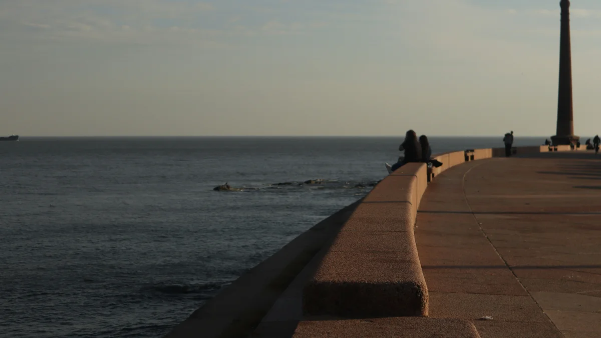
A continuous coastal promenade tracing Montevideo's entire waterfront for roughly 22 kilometers, often cited as the longest uninterrupted sidewalk in the world. It links the Old City to the beachside neighborhoods of Pocitos, Punta Gorda, and Carrasco, and is where much of daily Montevideo life happens — walking, cycling, and drinking mate along the Río de la Plata.
Visitor guide
The Rambla of Montevideo is a coastal avenue and promenade that follows the shore of the Rio de la Plata along the whole southern edge of the Uruguayan capital. Wikipedia says it runs for more than 22 kilometres without interruption, and that it has been proposed for UNESCO World Heritage status.
The Rambla was once called Rambla Naciones Unidas along its whole length, but it is now divided into named sections. It begins at the Port of Capurro on the Bay of Montevideo, passes the industrial Bella Vista and Aguada areas and runs through Ciudad Vieja, past the Mercado del Puerto and the Tower of Customs. Rambla Gran Bretana and Rambla Francia follow the southern waterfront of the old town near remnants of the old fortifications, including the Cubo del Sur.
Further east the Rambla Sur, built at the start of the twentieth century, transformed the city's outskirts. Wikipedia mentions that the construction of the Rambla took place in the 1910s overall. The promenade continues around Punta Carretas past Parque Rodo, the Teatro de Verano and a Holocaust memorial, and then runs along the beach at Pocitos, where the Yacht Club Montevideo is located.
Beyond Pocitos the Rambla passes Buceo, with its port, then Malvin and Punta Gorda, and the avenue ends at the Arroyo Carrasco, the city's eastern limit. Along the way are the Naval Museum, the Zoological and Oceanographic Museum, Plaza Armenia and an old Anglican temple. Ramirez Beach lies near the start of Rambla Presidente Wilson, close to the Mercosur Building.
The Rambla is described as central to Montevidean identity. People use it for walking, jogging, cycling, fishing and kite flying, and drinking mate, the traditional Uruguayan infusion, along the waterfront is a common pastime. Skateboarding and roller skating are allowed in designated areas. The beach is state owned, and building along the Rambla is strictly regulated, which keeps it open to the public.
The Rio de la Plata is an estuary on the north shore of which Montevideo stands. Buenos Aires lies about 230 kilometres to the west across the river, according to Wikipedia's article on Montevideo. Views of sunset and of the city skyline change with the season and the weather.
The Rambla is long enough that a private vehicle and driver is a practical way to see several of its sections in a single outing, with stops at Ciudad Vieja, Pocitos and Punta Carretas. Walking suits shorter segments. Beach use is heaviest in the warmer months, and the Tourism Police Unit patrols the avenue in summer, according to Wikipedia.
Along the route there are small parks, plazas and monuments, so the Rambla works as both a transport route and a public living room for the city. Its status as a candidate for UNESCO listing reflects how closely it is tied to daily life, and a local guide can point out the landmarks that mark each stretch of the shore.
See every tour and attraction we cover in Montevideo.