TorontoOntario · 36 tours
 Niagara FallsOntario · 25 tours
 New York CityNew York · 30 tours
 Las VegasNevada · 8 tours
 San FranciscoCalifornia · 16 tours
 VancouverBritish Columbia · 17 tours
 DubaiUAE · 54 tours
 Abu DhabiUAE · 5 tours
 Buenos AiresArgentina · 23 tours
 AthensGreece · 31 tours
 AucklandNew Zealand · 38 tours
 CancunMexico · 54 tours
No destinations match “”. Try searching all tours instead — that search understands full questions, not just place names.
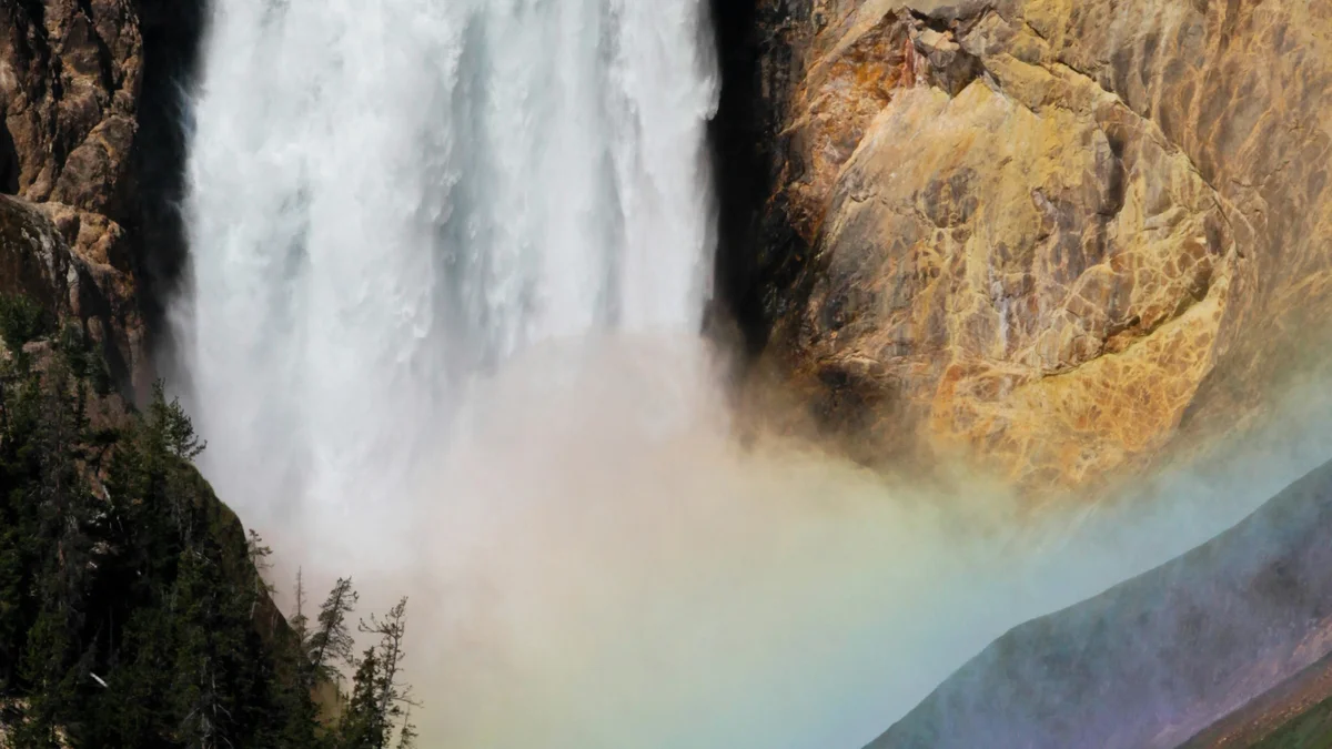
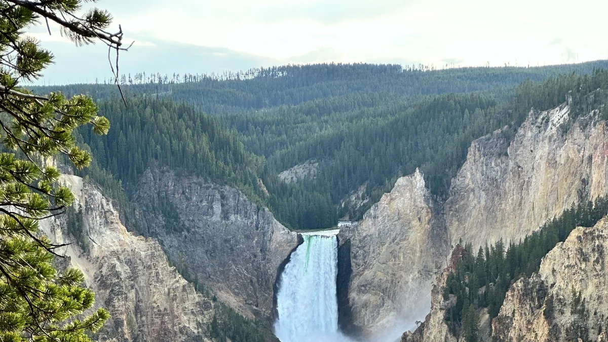
The Grand Canyon of the Yellowstone stretches roughly 20 miles, cut by the Yellowstone River through rock that's been chemically altered and colored by geothermal activity, giving the canyon walls their striking yellow, orange, and pink hues. The Lower Falls drop 308 feet, nearly twice the height of Niagara Falls, just downstream from the smaller Upper Falls. Artist Point and Inspiration Point on the canyon's south rim are the park's classic photo overlooks of the falls plunging into the gorge below.
Visitor guide
The Grand Canyon of the Yellowstone is the deep gorge the Yellowstone River has cut below Yellowstone Falls, its walls streaked in yellow, orange and red. At its head the river drops over two waterfalls, and the combination of colour, depth and falling water has made it one of the park's best-loved sights.
The National Park Service describes the canyon as roughly 20 miles (32 kilometres) long, more than 1,000 feet deep and 1,500 to 4,000 feet wide; Wikipedia's text gives a slightly longer length, so figures vary by source. The Upper Falls drop about 109 feet and the Lower Falls about 308 feet. The NPS says the canyon bends between the two, so there is no single spot from which both can be seen at once. Flow varies enormously with the season, from about 63,500 US gallons per second at peak runoff to about 5,000 gallons per second in late fall.
The NPS states that the canyon is an erosional feature, not a glacial one, describing it as a classic V-shaped valley carved by the river. The present canyon is no more than about 10,000 to 14,000 years old, though a canyon has probably existed here far longer. Faulting related to doming of the volcanic caldera likely let erosion work faster, and USGS geologist Ken Pierce has suggested that floods released when ice dams at the mouth of Yellowstone Lake broke at the end of the last glacial period played a part and may have happened more than once. The Lower Falls may exist because the river passes over rhyolite that resisted erosion better than the softer rock downstream.
That softer rock is the key to the colours. Heat and chemical action from an ancient geyser basin hydrothermally altered the rhyolite, and iron compounds in it oxidised as the walls were exposed. The NPS says most of the yellows in the canyon result from iron and sulfur in the rock.
Charles W. Cook saw the canyon in 1869 during the Cook-Folsom-Peterson Expedition, and Lt. Gustavus C. Doane described it in 1870 on the Washburn expedition. Painter Thomas Moran depicted it in 1872, and again in 1901, and his work helped spread its fame. In 1890 H.F. Richardson ran a ferry and guided tourists into the gorge below the Lower Falls; the original trail is gone, but the modern Uncle Tom's Trail follows a steep stairway to the base of the Lower Falls.
The NPS lists several viewpoints. Artist Point shows the Lower Falls, and the South Rim Trail has other views of it. The Upper Falls can be seen from two viewpoints and from the Brink of the Upper Falls Trail, reached by a spur road. On the North Rim, the Brink of the Lower Falls has paved accessible trails at the top and a steep descent for a closer look at the falls' power. The NPS cautions that the steep Brink and Red Rock Points trails are not recommended for visitors with heart, lung or other health conditions because of the climb back up.
Stay behind rails and on designated trails, and check the NPS for current trail conditions and access. A private vehicle and driver, as on a Voyzo private tour with door-to-door pickup, lets your group move between the North and South Rim viewpoints without shuttling cars or hunting for parking.
See every tour and attraction we cover in Yellowstone National Park.