TorontoOntario · 36 tours
 Niagara FallsOntario · 25 tours
 New York CityNew York · 30 tours
 Las VegasNevada · 8 tours
 San FranciscoCalifornia · 16 tours
 VancouverBritish Columbia · 17 tours
 DubaiUAE · 54 tours
 Abu DhabiUAE · 5 tours
 Buenos AiresArgentina · 23 tours
 AthensGreece · 31 tours
 AucklandNew Zealand · 38 tours
 CancunMexico · 54 tours
No destinations match “”. Try searching all tours instead — that search understands full questions, not just place names.
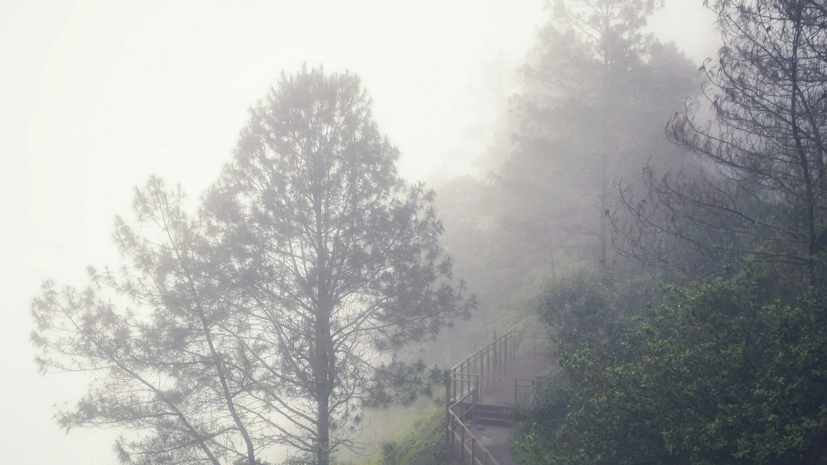
The crater of San Salvador Volcano (Volcán Quezaltepec), a national park perched directly above the capital. The main crater is about 558 meters (1,831 feet) deep, with published widths ranging from about 1.5 to 5 kilometers, and a smaller cinder cone formed inside it in the 1917 eruption, with walking trails along its forested rim and views back down over the city.
Visitor guide
El Boquerón National Park is a protected area on the San Salvador Volcano, known as Quezaltepeque or El Boquerón, just northwest of the Salvadoran capital. The park centres on a large summit crater with a smaller cinder cone inside it. Its cool climate, forest and rim trails make it a nearby highland escape from the city below.
According to Wikipedia, the park sits on top of the San Salvador Volcano at about 1,800 metres above sea level and was designated in 2008. It is run by the Ministry of the Environment and Natural Resources and is listed as an IUCN Category II national park covering about 2.05 square kilometres. The nearest city is San Salvador, whose western districts lie on the volcano's slopes.
The park's main feature is the crater. Wikipedia's park article gives its size as about 5 kilometres across and 558 metres deep, while the article on the volcano itself gives roughly 1.5 kilometres across and 500 metres deep, so published figures differ. Either way it is a dramatic open pit, ringed by forested walls where, according to the volcano article, local residents grow crops on the upper slopes. Inside it stands a smaller cinder cone called Boqueroncito, meaning little Boquerón. The word Boquerón roughly means big mouth in Spanish.
The volcano's recorded eruptions since 600 CE include events around 640 CE, 1200, 1575, 1658 to 1659, an unconfirmed event in 1806, and 1917. On 7 June 1917, after two strong earthquakes in San Salvador with magnitudes of about 6.5 and 6.4, the volcano erupted. The eruption was rated VEI 3 and Strombolian in style, producing ash and a basaltic lava flow. Fissures opened on the northwest flank, the summit crater lake evaporated within a month, and the cinder cone Boqueroncito, about 30 to 40 metres tall, formed. Activity ended in November 1917.
The wider volcano also has an older legacy: the Loma Caldera eruption buried the ancient village of Joya de Cerén, and the El Playón eruption of 1658 to 1671 buried the town of Nexapa, according to Wikipedia.
The San Salvador Volcano is a stratovolcano formed where the Cocos plate subducts beneath the Caribbean plate, part of the Central America Volcanic Arc. Its rocks are mainly basalt and andesite. The prominent peak El Picacho is the volcano's highest point, with television and radio antennas standing on it and within the Boquerón crater. Sources give slightly different heights for the volcano.
The park has a cool temperate climate year round. Wikipedia lists ornamental-type plants such as cartuchos, hydrangeas and begonias, as well as wild grapevines, and animals including armadillos, raccoons, deer and foxes. Short hiking trails run up the side of the crater and along its rim, with a visitors' centre.
A private guided visit is a good way to combine the crater rim views with the volcano's history.
See every tour and attraction we cover in San Salvador.