TorontoOntario · 36 tours
 Niagara FallsOntario · 25 tours
 New York CityNew York · 30 tours
 Las VegasNevada · 8 tours
 San FranciscoCalifornia · 16 tours
 VancouverBritish Columbia · 17 tours
 DubaiUAE · 54 tours
 Abu DhabiUAE · 5 tours
 Buenos AiresArgentina · 23 tours
 AthensGreece · 31 tours
 AucklandNew Zealand · 38 tours
 CancunMexico · 54 tours
No destinations match “”. Try searching all tours instead — that search understands full questions, not just place names.
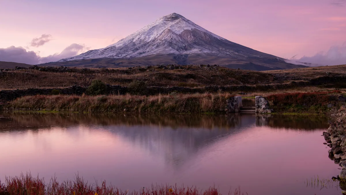
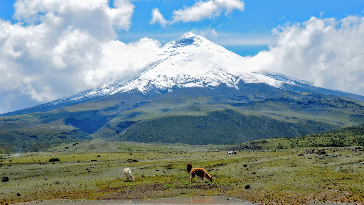
Cotopaxi National Park protects one of the world's highest active volcanoes, a near-symmetrical, snow-capped cone rising to 5,897 meters (19,347 feet). The park's high-altitude páramo grassland is home to wild horses and native birdlife, and hiking trails lead up to the José Rivas climbers' refuge for close-up views of the summit.
 Private Tours
A private day trip to Cotopaxi National Park, driving along the Avenue of the Volcanoes to Limpiopungo Lagoon and hiking up to the José Rivas climbers' refuge at nearly 4,900 meters.
 Private Tours
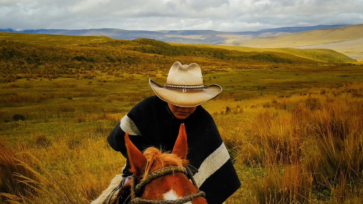
An exclusive private day trip combining a 2-3 hour horseback ride around the grassland at the base of Cotopaxi Volcano with a hike around Limpiopungo Lagoon, plus a boxed lunch.
Visitor guide
Cotopaxi National Park protects the area around Cotopaxi, an active stratovolcano in Ecuador's Andes that rises to 5,897 metres, about 50 kilometres south of Quito. Its near-perfect snow-capped cone, high-altitude páramo and mountain refuges make it one of the best-known landscapes in the country.
According to Wikipedia, Cotopaxi is the second-highest summit in Ecuador after Chimborazo and ranks among the highest active volcanoes in the world. It belongs to the Pacific Ring of Fire. The nearly symmetrical cone rises from a plateau of about 3,800 metres, with a base roughly 23 kilometres wide and a summit crater about 800 by 550 metres. A glacier, one of the few equatorial glaciers on Earth, begins at about 5,000 metres. The volcano is often shrouded in cloud, so clear views are never guaranteed.
Local explanations of the name link it to the crescent-shaped crater, combining words for neck or throat and moon. Andean peoples regarded the mountain as sacred long before the Inca, seeing it as a sender of rain and a guarantor of fertility. Wikipedia counts roughly 87 eruptions, the first recorded in 1534. The eruptions of 1744 and 1768 destroyed the colonial town of Latacunga, and in 1877 pyroclastic flows melted the glacier cap and sent lahars more than 100 kilometres to the Pacific and the Amazon basin. Members of the French Geodesic Mission witnessed the 1742 eruption.
Alexander von Humboldt attempted the mountain in 1802 and reached roughly 4,500 metres. The German geologist Wilhelm Reiss and the Colombian Ángel Escobar made the first ascent on 28 November 1872. The José Rivas refuge, built in 1971 at about 4,864 metres, serves as a base for climbers and a destination for day hikers who walk up from the car park for close views of the glacier. Summit climbs require mountaineering equipment and experienced guides.
The park's high grasslands, called páramo, are home to Andean birds such as the Andean teal and Andean lapwing, seen near Limpiopungo lagoon at about 3,780 metres. Travel writing also mentions the wild horses that roam the park, and the aster known locally as chikku chikku grows at high Andean elevations. The plateau offers wide views of the surrounding peaks.
The park is a regular stop on the Avenue of the Volcanoes, and day trips from Quito are common. Because of altitude, strong sun and rapid weather changes, a gradual pace, warm layers and sun protection are advised. A private guide and driver can adjust the plan to the day's visibility.
Wikipedia says the national park was established on 11 August 1975, covers 33,393 hectares and is an IUCN Category II protected area. It extends across parts of Cotopaxi, Napo and Pichincha provinces. Besides Cotopaxi, it includes Rumiñawi, a dormant volcano to the northwest, and Sincholagua, a historically active volcano to the southeast whose last major eruption was in 1877. Cotopaxi's most recent eruptive episode listed there began on 14 August 2015 and ended on 24 January 2016. The park's categories mention páramo and montane forest ecosystems.
See every tour and attraction we cover in Quito.