TorontoOntario · 36 tours
 Niagara FallsOntario · 25 tours
 New York CityNew York · 30 tours
 Las VegasNevada · 8 tours
 San FranciscoCalifornia · 16 tours
 VancouverBritish Columbia · 17 tours
 DubaiUAE · 54 tours
 Abu DhabiUAE · 5 tours
 Buenos AiresArgentina · 23 tours
 AthensGreece · 31 tours
 AucklandNew Zealand · 38 tours
 CancunMexico · 54 tours
No destinations match “”. Try searching all tours instead — that search understands full questions, not just place names.
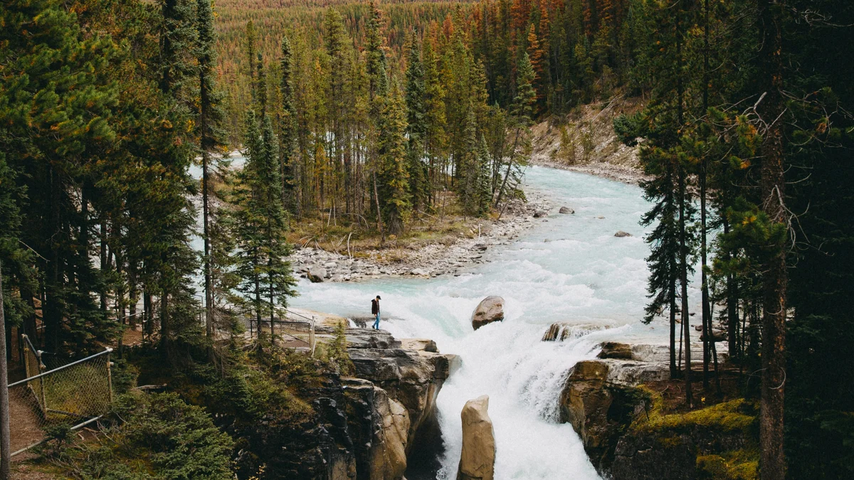
Though not the tallest waterfall in the Canadian Rockies, Athabasca Falls is one of the most powerful, funneling the full force of the Athabasca River through a narrow gap in ancient quartzite and limestone bedrock. The surrounding canyon has been carved into potholes and abandoned channels by centuries of erosion, and paved viewing platforms and short trails let visitors get close to the roar and spray along the Icefields Parkway.
Visitor guide
Athabasca Falls is a waterfall on the Athabasca River in Jasper National Park, about 30 kilometres south of Jasper townsite beside the Icefields Parkway. It is not tall, but the volume of water forced through a narrow gorge makes it one of the most powerful falls in the Canadian Rockies' mountain parks.
Wikipedia gives the total drop as about 24 metres (79 feet), in two stages with a longest single drop of around 20 metres, while Parks Canada describes the falls as 23 metres; sources round the figure differently, so treat it as roughly 23 to 24 metres. Wikipedia lists an average flow of about 113 cubic metres per second and a width of up to 46 metres. The reputation rests on force rather than height: the river is funnelled into a constricted channel and thunders into the gorge.
Parks Canada explains that the river pours over hard quartzite and has cut into the softer limestone beneath it. That contrast has carved potholes and a short canyon, and the walkways let you look down into the polished, curved rock where the water has worked for thousands of years. Look also for sections of the canyon that the river no longer uses, left dry as the channel shifted over time.
The Athabasca River has long been a travel corridor. Parks Canada notes that David Thompson travelled it in 1810 and 1811 searching for a fur-trade route to the Pacific and found Athabasca Pass, and that in 1862 the Overlanders followed the river toward the Cariboo gold rush. About three decades later two national railways were built nearby, and today a railway and a transcontinental highway still follow parts of the river. The Athabasca was designated a Canadian Heritage River in 1989.
The day-use area is reached from Highway 93A, just off the Icefields Parkway, and Parks Canada places it about 31 kilometres from Jasper. Paved paths and viewing platforms circle the gorge, and a historic vehicle bridge and a pedestrian bridge cross the river near the falls. Some sections include stairs and uneven ground, so mobility varies by route.
Safety matters here. Parks Canada warns that mist leaves a thin, slippery film on the surrounding rock and asks visitors to stay on designated trails and behind railings; the rock beyond is dangerous and the river is cold and fast. Footbridge and trail sections have been closed for repairs in the past, so check Parks Canada for current access, closures and facilities. Mist can also create rainbows on bright mornings when the light hits the spray at the right angle, but that varies with sun and flow.
Whitewater rafting trips often begin below the falls and run downstream toward Jasper, which gives a very different view of the same river.
Leave enough time to walk the platforms on both sides of the gorge and to photograph from several angles. On a Voyzo private tour, your driver can pick the time to suit your group and stop here on the way to or from the Columbia Icefield, since it lies on the route south.
Sunwapta Falls lies farther south on the Icefields Parkway, about 54 kilometres from Jasper per Parks Canada, and the Columbia Icefield is farther still. Closer to town you will find Pyramid Lake and the SkyTram.
See every tour and attraction we cover in Jasper.