TorontoOntario · 36 tours
 Niagara FallsOntario · 25 tours
 New York CityNew York · 30 tours
 Las VegasNevada · 8 tours
 San FranciscoCalifornia · 16 tours
 VancouverBritish Columbia · 17 tours
 DubaiUAE · 54 tours
 Abu DhabiUAE · 5 tours
 Buenos AiresArgentina · 23 tours
 AthensGreece · 31 tours
 AucklandNew Zealand · 38 tours
 CancunMexico · 54 tours
No destinations match “”. Try searching all tours instead — that search understands full questions, not just place names.
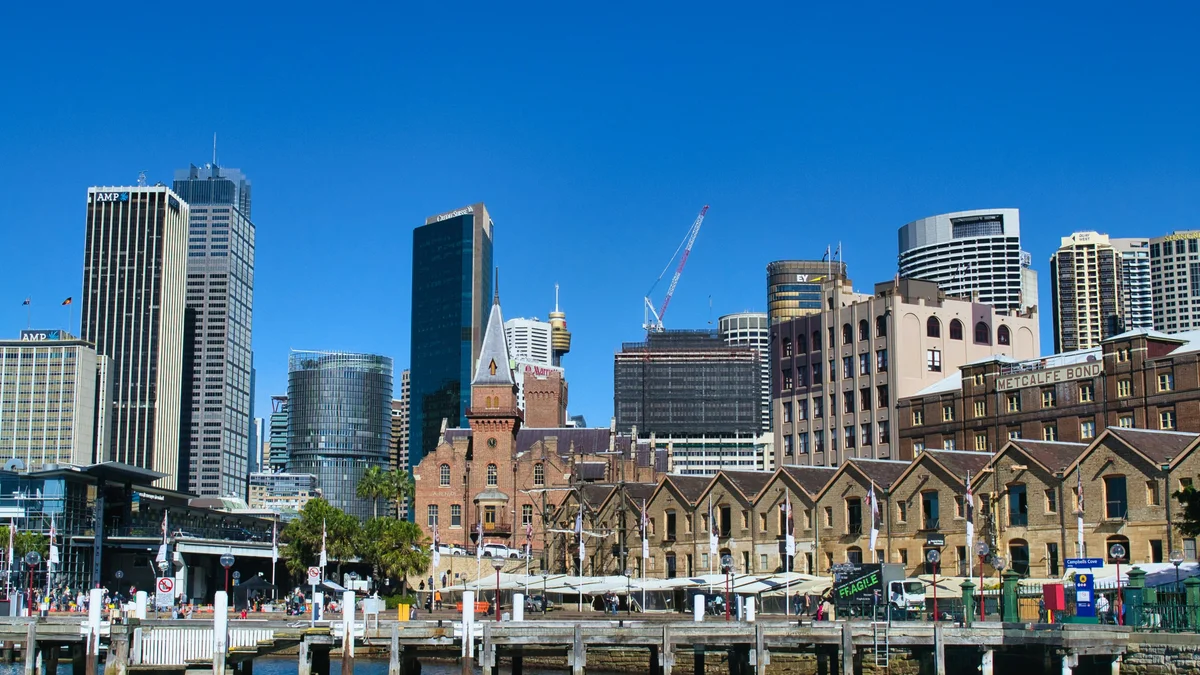
This waterfront district was the site of Australia's first European settlement in 1788 and takes its name from the sandstone outcrops the early colony was built on. Narrow cobblestone lanes wind past preserved 19th-century warehouses and colonial buildings, including the historic Metcalfe Bond stores overlooking Campbell's Cove. A weekend market fills the streets with stalls, and the area sits directly beneath the southern pylons of the Harbour Bridge.
Visitor guide
The Rocks is a historic waterfront district on the southern shore of Sydney Cove in Sydney, New South Wales, Australia, established shortly after the colony was founded in 1788. Its sandstone buildings, narrow lanes, museums and weekend market sit directly beneath the southern approaches of the Sydney Harbour Bridge.
Wikipedia says The Rocks was established soon after the colony's formation in 1788. The Cadigal people called the area Tallawoladah. The first buildings were wattle-and-daub houses with thatched roofs, later replaced by local sandstone, which gave the area its name. For much of the nineteenth century it was the convicts' side of town and had a rough reputation, and by 1823 about 1,200 people lived there. A gang known as the Rocks Push dominated the district in the late nineteenth century.
Bubonic plague broke out in 1900, and the state government resumed land around The Rocks and Darling Harbour with the aim of demolishing and rebuilding it. More than 3,800 houses, buildings and wharves were inspected and hundreds were demolished. World War I halted further plans. In the 1920s several hundred more buildings were demolished to build the Sydney Harbour Bridge.
In February 1971 local residents formed the Rocks Residents Action Group to oppose redevelopment plans by the Sydney Cove Redevelopment Authority, fearing that they would be displaced. The Builders Labourers Federation imposed a green ban that was in place by 1973, and a People's Plan followed. The ban held until 1975, and the area was then renovated into a commercial and tourist precinct rather than being demolished, which is why so many historic buildings survive.
The Rocks has many heritage-listed sites, including Argyle Cut, Cadmans Cottage, Susannah Place, Campbells Stores and the Metcalfe Bond Stores. The Argyle Cut was built with convict labour. Susannah Place Museum is four terrace houses built in 1844 that were occupied until 1990. The Dawes Point Battery, described by Wikipedia as the first fortified position in New South Wales, and the Sydney Observatory are included on historic walks. The Museum of Contemporary Art is nearby on the Circular Quay side.
Church Hill, in the southern part of The Rocks, was named for early churches there, including St Patrick's, St Philip's and the Scots Church. Governor Philip Gidley King laid the foundation stone for St Philip's on 1 October 1800, and in 1802 it became one of Australia's first two parishes.
The Rocks Market runs each weekend with around 100 stalls, according to Wikipedia. Its pubs, restaurants and galleries make it a natural stop before or after the Harbour Bridge and Opera House. At the 2021 census 629 people lived in the district. Its compact layout lends itself to a guided walk, and a private tour can add historical context for each lane and building.
See every tour and attraction we cover in Sydney.