TorontoOntario · 36 tours
 Niagara FallsOntario · 25 tours
 New York CityNew York · 30 tours
 Las VegasNevada · 8 tours
 San FranciscoCalifornia · 16 tours
 VancouverBritish Columbia · 17 tours
 DubaiUAE · 54 tours
 Abu DhabiUAE · 5 tours
 Buenos AiresArgentina · 23 tours
 AthensGreece · 31 tours
 AucklandNew Zealand · 38 tours
 CancunMexico · 54 tours
No destinations match “”. Try searching all tours instead — that search understands full questions, not just place names.
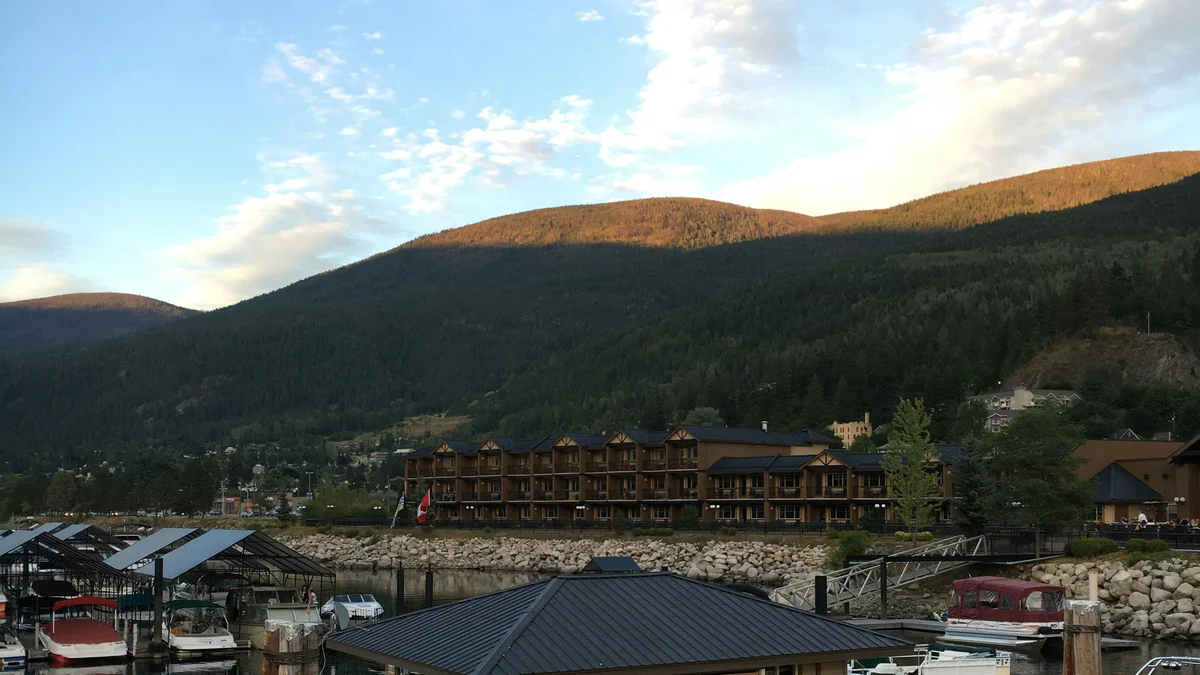
One of the largest natural lakes in British Columbia, stretching more than 100 kilometres through the Selkirk and Purcell mountains. Nelson sits on its western shore, with the Kootenay Lake Ferry, one of the longest free ferry rides in the world, crossing its Balfour narrows.
Visitor guide
Kootenay Lake is a long, narrow lake in southeastern British Columbia, running about 104 kilometres between the Selkirk and Purcell mountains and rarely more than 3 to 5 kilometres wide. Nelson sits at the end of its West Arm, and a free vehicle ferry across the main lake between Balfour and Kootenay Bay is one of the region's best-known drives.
The lake's surface sits at about 532 metres above sea level, and its maximum depth is about 150 metres. Wikipedia describes it as eroded by rivers from the late Cretaceous and reshaped by Pleistocene glaciation. A moraine near Libby, Montana, redirected drainage southward for a time before the Kootenay River took its present course. The Kootenay River is both the main inflow and the main outflow, and its water reaches the Columbia River at Castlegar. Its water level is managed: Corra Linn Dam, which opened in 1932 at the outlet, raises the normal level by roughly 2 metres, and Duncan Dam (1967) on the Duncan River and Libby Dam (1975) in Montana were both built under the Columbia River Treaty.
The Sinixt and Ktunaxa peoples used the lake and its river systems for seasonal travel and trade. In the steamboat era, vessels such as the sternwheelers Moyie and City of Ainsworth served the lake's mining and settlement towns. Today about 19,700 people live within 2.5 kilometres of the shore, roughly half of them in Nelson. Other lakeside communities include Kaslo, Balfour, Ainsworth Hot Springs, Crawford Bay, Riondel and Gray Creek.
The Kootenay Lake Ferry links Balfour on the west side with Kootenay Bay on the east side along Highway 3A, about 35 kilometres east of Nelson. The BC government lists a crossing time of 35 minutes. The main vessel is the Osprey 2000, with the MV Balfour added in summer and used as a substitute during maintenance. Regional tourism sources promote it as the longest free ferry in the world; that superlative is a promotional claim, so we treat it as popular rather than formally verified. Published vehicle and passenger capacities differ between sources, so check the BC government page or the operator for current sailings and capacity.
Species in the lake include rainbow trout, bull trout, kokanee, burbot, mountain whitefish and white sturgeon. Kokanee in the West Arm declined sharply in the late 1970s and the fishery there was closed in 1980. Wikipedia lists several possible causes, including changes to food supply and water-level management. The Creston Valley wetlands at the lake's southern end, which the lake once flooded seasonally, have largely been diked for agriculture, though a smaller wetland area is protected.
See every tour and attraction we cover in Kootenay Rockies.