TorontoOntario · 36 tours
 Niagara FallsOntario · 25 tours
 New York CityNew York · 30 tours
 Las VegasNevada · 8 tours
 San FranciscoCalifornia · 16 tours
 VancouverBritish Columbia · 17 tours
 DubaiUAE · 54 tours
 Abu DhabiUAE · 5 tours
 Buenos AiresArgentina · 23 tours
 AthensGreece · 31 tours
 AucklandNew Zealand · 38 tours
 CancunMexico · 54 tours
No destinations match “”. Try searching all tours instead — that search understands full questions, not just place names.
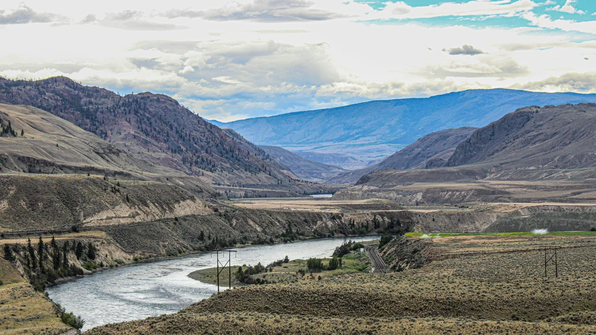
Sandstone cliffs and hoodoo-style rock formations shaped by erosion, part of the semi-arid landscape surrounding the city.
Visitor guide
Kamloops has two quite different sets of hoodoos: pale silt pillars and bluffs left by an Ice Age lake, and rust-coloured volcanic hoodoos on Cinnamon Ridge. Both are scenic, but they have different geology and different rules for visiting.
Tourism Kamloops explains that the silt plateaus along East Shuswap Road are the remains of an ancient glacial lake floor. Near the end of the last Ice Age, glacier ice dammed water in the South Thompson valley. Glacial meltwater carried fine sediment, often called rock flour because it comes from glaciers grinding rock, into that lake, and tens of metres of silt built up on the bottom. When the ice retreated and the lake drained, the South Thompson River re-established itself and cut down through the soft deposits, leaving the old lake floor standing as benchlands and bluffs that wind and rain have carved into ridges and columns. Wikipedia describes two large glacial lakes, Glacial Lake Thompson and Glacial Lake Deadman, as occupying much of the river's course between roughly 13,000 and 10,000 BCE, but sources give different timelines, so dates are best treated as approximate. A Geological Survey of Canada GeoTour guide to Kamloops, produced with Thompson Rivers University, includes a stop on the origins of these ancient glacial lake silt benches in eastern Kamloops, which shows how typical the landform is of the valley.
Kamloops sits in the rain shadow of the Coast Mountains and is classed as semi-arid, with Wikipedia giving average annual precipitation of only about 278 millimetres. Dry, sparsely vegetated silt erodes readily, which helps explain why the formations are so visible. The same source lists ponderosa pine, big sagebrush and prickly pear cactus among the native plants, and notes the area's links to the Okanagan and to the semi-desert country farther south. The city lies at about 345 metres elevation where the North and South Thompson rivers meet; its name comes from the Secwépemc word Tk'emlúps, usually translated as meeting of the waters.
Tourism Kamloops describes this as a scenic drive rather than a hike, and asks visitors to respect the wishes of Tk'emlúps te Secwépemc, on whose land the formations sit, by enjoying the view from the vehicle and not stopping along the route. A driver-led approach suits that request well. The same guide suggests continuing along the road to Sagewood Winery or Monte Creek Winery before returning to Kamloops, and notes the South Thompson Inn at the foot of the hoodoos.
Dallas-Barnhartvale Nature Park, a municipal park, has silt bluffs from the same glacial lake. Tourism Kamloops says the best hoodoo views are on its Pussy Willow or Hoodoo trail, and that walkers can climb through the bluffs to the top of the benchlands for a view over the South Thompson valley. Cinnamon Ridge is different: Tourism Kamloops describes its hoodoos as the eroded remains of a volcano that erupted about 50 million years ago, with weathering iron staining the rock cinnamon brown. That age fits the Eocene volcanic and sedimentary rocks around Kamloops that geologists call the Kamloops Group, which G. M. Dawson first described in 1896, according to a 1979 provincial geological paper. The Cinnamon Ridge trail is rated difficult, with steep climbs, loose gravel, slot-like canyons cut by an old creek bed and little shade; prickly-pear cactus grows on the south-facing slopes. Tourism Kamloops says reaching it by crossing the railway tracks from Tranquille Road is illegal and dangerous, and directs visitors to a different access. Check Tourism Kamloops and the city for current access.
Because stopping is discouraged along the road, a private vehicle and driver with door-to-door pickup lets your group view the bluffs from the car at an unhurried pace, then continue to a winery or the city.
See every tour and attraction we cover in Kamloops.