TorontoOntario · 36 tours
 Niagara FallsOntario · 25 tours
 New York CityNew York · 30 tours
 Las VegasNevada · 8 tours
 San FranciscoCalifornia · 16 tours
 VancouverBritish Columbia · 17 tours
 DubaiUAE · 54 tours
 Abu DhabiUAE · 5 tours
 Buenos AiresArgentina · 23 tours
 AthensGreece · 31 tours
 AucklandNew Zealand · 38 tours
 CancunMexico · 54 tours
No destinations match “”. Try searching all tours instead — that search understands full questions, not just place names.
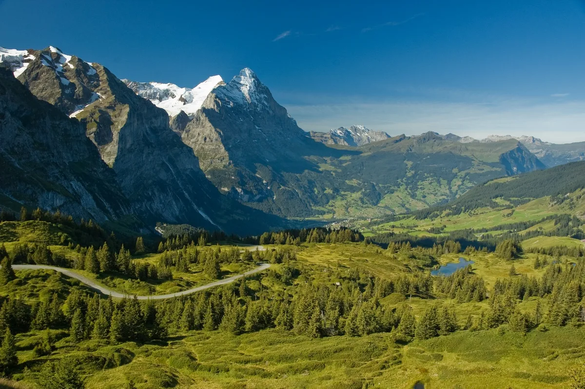
A scenic mountain highway climbing to over 2,500 metres past Austria's highest peak, the Grossglockner, with switchback views over glaciers and alpine valleys.
Visitor guide
The Grossglockner High Alpine Road (Großglockner Hochalpenstraße) is, according to Wikipedia, the highest surfaced mountain pass road in Austria. It links Bruck in the state of Salzburg with Heiligenblut in Carinthia over the Fuscher Törl at 2,428 metres and the Hochtor Pass at 2,504 metres, and is named after the Grossglockner, Austria's highest mountain.
From Bruck in the Salzach Valley the road climbs through numbered hairpin bends from the Ferleiten toll station up to the Hochtor Pass, with a 1.5-kilometre branch from Fuscher Törl to the Edelweißspitze viewpoint at 2,571 metres. The road crosses the Alpine divide through a tunnel and continues south, where a further branch leads to the Glocknerhaus mountain hut and the Kaiser-Franz-Josefs-Höhe visitor centre at 2,369 metres.
The Kaiser-Franz-Josefs-Höhe overlook was named after a visit by Emperor Franz Joseph I and Empress Elisabeth in 1856. It offers a panorama over the Pasterze glacier, the Grossglockner massif, the Glocknerwand and the Johannisberg. The Pasterze is the longest glacier in Austria and the Eastern Alps at about 8.4 kilometres, and a funicular railway opened in 1963 leads down to its margin.
Austrian experts presented a plan for a road over the Hochtor in 1924 and were ridiculed at a time when Austria was economically weakened after World War I. The project was revived after the 1929 stock market crash as a job-creation scheme, employing 3,200 workers when unemployment had risen to 26%. It was widened to 6 metres in the belief that 120,000 visitors a year would come, with the state advancing the cost and tolls repaying it.
The first explosives were set off at Ferleiten on 30 August 1930. The road was opened on 3 August 1935 and put into full service the next day with an international automobile and motorcycle race. Planners had reckoned on 120,000 visitors, but in 1938 about 375,000 came. Wikipedia notes that the later opening of the Felbertauern Road in 1967 and the Tauern Motorway in 1975 changed its role from the main transalpine crossing to an excursion road.
The Grossglockner stands at 3,798 metres and is the highest mountain in Austria and in the Alps east of the Brenner Pass. Its pyramid-shaped peak has two pinnacles, the Grossglockner and the Kleinglockner at 3,770 metres. The surrounding area has been part of the Grossglockner-Pasterze special protected area within the Hohe Tauern National Park since 1986.
Hohe Tauern National Park is the largest of Austria's six national parks and the largest national park in the Alps, with an area of about 1,856 square kilometres. Its fauna includes chamois, Alpine ibex, red deer, golden eagle and griffon vulture, and reintroduced bearded vultures and Alpine marmots.
Snow clearing is a major annual undertaking. In 1936 and 1937 some 350 men shovelled 250,000 cubic metres of snow, and today rotary ploughs clear hundreds of thousands of cubic metres each April. The road is normally open from early May to the end of October, with exact dates depending on conditions. The Grossglockner has also featured twice in the Giro d'Italia, in 1971 and 2011.
Weather at this altitude can change quickly, and views are best on clear days. A private guided drive, with a driver handling the hairpins, lets passengers concentrate on the viewpoints and glacier scenery.
See every tour and attraction we cover in Austria.