TorontoOntario · 36 tours
 Niagara FallsOntario · 25 tours
 New York CityNew York · 30 tours
 Las VegasNevada · 8 tours
 San FranciscoCalifornia · 16 tours
 VancouverBritish Columbia · 17 tours
 DubaiUAE · 54 tours
 Abu DhabiUAE · 5 tours
 Buenos AiresArgentina · 23 tours
 AthensGreece · 31 tours
 AucklandNew Zealand · 38 tours
 CancunMexico · 54 tours
No destinations match “”. Try searching all tours instead — that search understands full questions, not just place names.
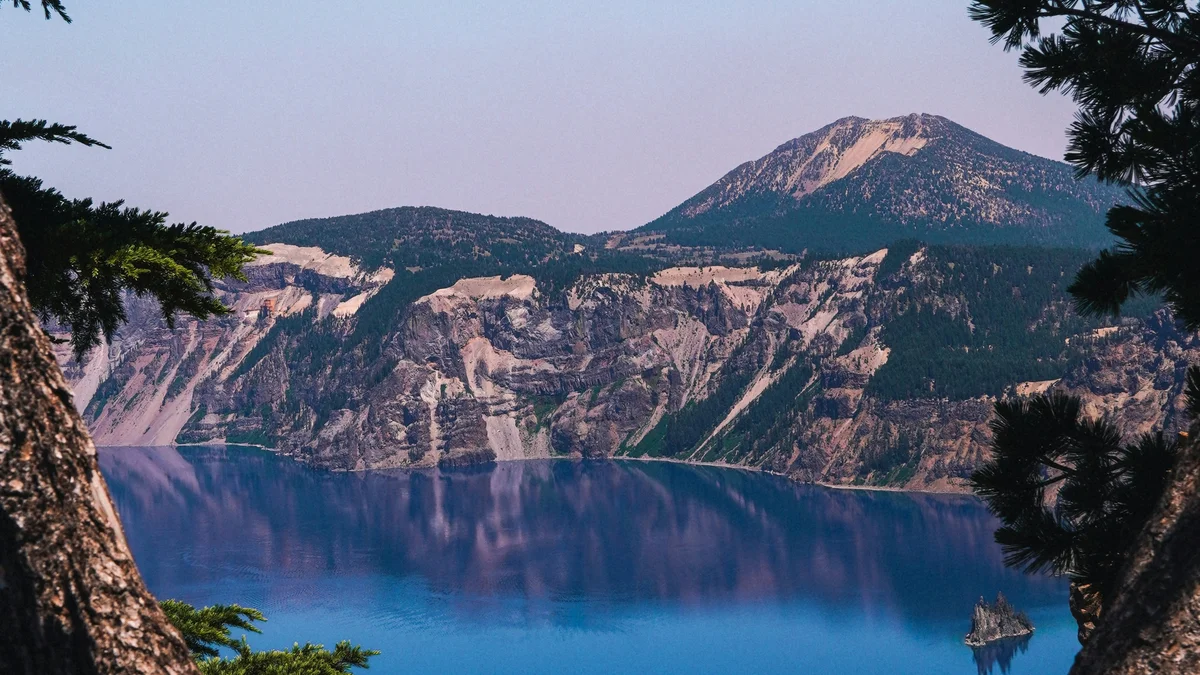
Mount Scott is a real 8,929-foot peak on the eastern rim of Crater Lake National Park, the highest point in the park and a genuine remnant of the volcanic activity that shaped the surrounding landscape. The Park Service lists the trail at 4.4 miles round trip with about 1,250 feet of elevation gain, ending at a fire lookout at the summit, rewarding hikers with sweeping views over the entire caldera and, on clear days, distant Cascade peaks. It's a genuinely strenuous hike compared to the park's easier viewpoints along Rim Drive.
Visitor guide
Mount Scott is the highest point in Crater Lake National Park, Oregon, at 8,929 feet (2,721 m) according to the National Park Service. It rises on the park's eastern side, outside the caldera rim, and a trail from East Rim Drive climbs to a small fire lookout tower at the summit. The Park Service calls the view the only one of the entire lake from within the park.
Mount Scott is a small stratovolcano and parasitic cone on the southeast flank of the Mount Mazama volcanic complex. The Park Service gives its age as about 425,000 years, while Wikipedia says it first erupted about 420,000 years ago; either way it is among the older volcanoes of the Mazama complex. It mainly produced andesitic lava and became extinct in the late Pleistocene. Because it stands well away from Mazama's main flanks, it survived the eruption and collapse about 7,700 years ago that formed the caldera. The lower slopes are mostly ash, pumice, and loose gravel, and the summit is mostly scoria.
Published elevations vary slightly: the National Park Service lists 8,929 feet, while Wikipedia gives 8,934 feet. Wikipedia describes it as the tenth-highest peak in the Oregon Cascades, with roughly 3,000 feet of prominence. The mountain is named for Levi Scott, an Oregon pioneer who founded Scottsburg, Oregon.
The Park Service lists the Mount Scott trail at 4.4 miles round trip with about 1,250 feet of elevation gain, starting from a trailhead on East Rim Drive about 14 miles east of park headquarters. Wikipedia gives a slightly different figure, about 2.5 miles one way with roughly 1,479 feet of gain from a trailhead at about 7,683 feet, so expect small differences depending on how it is measured. The route uses many switchbacks and passes whitebark pines, with wildflowers such as Indian paintbrush and penstemon noted on the mountain. It ends at the fire lookout tower on the summit.
From the top the lake spreads out below, and Wikipedia lists distant landmarks including Mount Thielsen, Diamond Peak, Mount McLoughlin, Mount Shasta, Upper Klamath Lake, and Diamond Lake. What you see depends on weather and smoke. Because the summit stands near 9,000 feet, wind and cold can arrive quickly even in summer.
The trailhead sits along East Rim Drive, which is seasonal, so access depends on snow and road conditions. Check the National Park Service for current trail and road status, fees, and any closures.
On a private Crater Lake day, a Voyzo driver can bring your group to the trailhead and collect you at the end, which is handy on a hike that ends at the same spot you started. It also pairs naturally with the overlooks along East Rim Drive. Door-to-door pickup means no one has to organize parking at the trailhead.
See every tour and attraction we cover in Crater Lake National Park.