TorontoOntario · 36 tours
 Niagara FallsOntario · 25 tours
 New York CityNew York · 30 tours
 Las VegasNevada · 8 tours
 San FranciscoCalifornia · 16 tours
 VancouverBritish Columbia · 17 tours
 DubaiUAE · 54 tours
 Abu DhabiUAE · 5 tours
 Buenos AiresArgentina · 23 tours
 AthensGreece · 31 tours
 AucklandNew Zealand · 38 tours
 CancunMexico · 54 tours
No destinations match “”. Try searching all tours instead — that search understands full questions, not just place names.
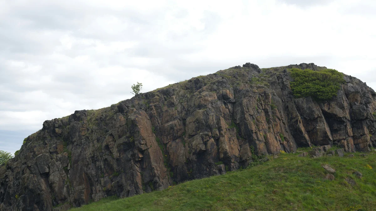
Arthur's Seat is a real extinct volcano rising 822 feet above Edinburgh within Holyrood Park, formed around 350 million years ago and later carved by glaciers into its current shape. A network of trails leads to the summit, with the most popular route taking most hikers roughly one to two hours round trip. On a clear day, the summit offers sweeping views across Edinburgh, the Firth of Forth, and out toward the surrounding countryside.
Visitor guide
Arthur's Seat is an extinct volcano and the main peak of the hills that make up Holyrood Park in Edinburgh, Scotland, about a mile east of Edinburgh Castle. Rising to roughly 251 metres, it gives wide views over the city and the Firth of Forth and is one of Edinburgh's best-known hillwalks.
Arthur's Seat is the largest part of the Arthur's Seat Volcano Site of Special Scientific Interest, which also includes Calton Hill and Castle Rock. Wikipedia dates the volcanic system to the early Carboniferous period, with lava samples dated to 341 to 335 million years ago. During the Quaternary, a glacier moving from west to east eroded the hill, exposing rocky crags on the west side, which became Salisbury Crags, and leaving a tail of material to the east. From some angles the hill resembles a lion lying down, with two extinct vents forming the Lion's Head and Lion's Haunch.
Hutton's Section, in Salisbury Crags, shows dolerite sills where magma pushed through sedimentary rock. Observations here by James Hutton helped shape modern geology.
An early name recorded in the charters of Holyrood Abbey is Craggenmarf. The name Arthur's Seat is sometimes said to come from legends about King Arthur, but this is presented as a claim rather than a confirmed origin, and similar names appear elsewhere in Britain. The earliest known Arthurian-style form, Arthurissete, appears in a 1508 work by Walter Kennedy. The hill is often cited as one possible location for Camelot, which is a tradition rather than a historical finding.
A hill fort occupies the summit area, with further defences visible at Dunsapie Hill and above Samson's Ribs; these are of prehistoric date. They may have been centres of power for the Votadini, the people of the poem Y Gododdin. Cultivation terraces can be seen from Duddingston. On 1 May 1590 a bonfire on Salisbury Crags celebrated the safe return of James VI and Anne of Denmark.
The Radical Road runs beneath Salisbury Crags and was built after the Radical War of 1820 using unemployed weavers, following a suggestion by Walter Scott. In 1836 five boys found 17 miniature coffins containing small wooden figures in a cave on the crags; their purpose remains unknown, and the surviving coffins are in the National Museum of Scotland.
Tradition says David I, while hunting nearby, saw a vision of a cross between a stag's antlers and founded Holyrood Abbey. Young Edinburgh women also traditionally washed their faces in May Day dew on the slopes, a custom celebrated in Robert Fergusson's 1773 poem Caller Water.
The easiest ascent is from the east, up a grassy slope above Dunsapie Loch. Historic Environment Scotland looks after the surrounding park. Robert Louis Stevenson described the hill as one for magnitude, a mountain in virtue of its bold design. Conditions can be windy and the paths uneven, so sturdy footwear is sensible; a private guide with a driver can drop you at a convenient starting point.
See every tour and attraction we cover in Edinburgh.