TorontoOntario · 36 tours
 Niagara FallsOntario · 25 tours
 New York CityNew York · 30 tours
 Las VegasNevada · 8 tours
 San FranciscoCalifornia · 16 tours
 VancouverBritish Columbia · 17 tours
 DubaiUAE · 54 tours
 Abu DhabiUAE · 5 tours
 Buenos AiresArgentina · 23 tours
 AthensGreece · 31 tours
 AucklandNew Zealand · 38 tours
 CancunMexico · 54 tours
No destinations match “”. Try searching all tours instead — that search understands full questions, not just place names.
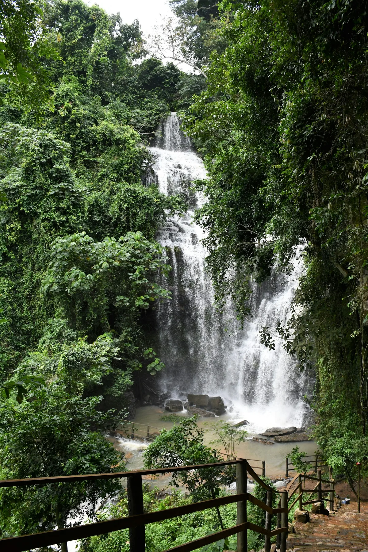
Ghana's tallest waterfall, dropping over 80 meters in the Agumatsa Wildlife Sanctuary near Hohoe in the Volta Region, reached by a forest trail that's home to large colonies of fruit bats.
Visitor guide
Wli Waterfalls, known locally as Agoomatsa or Agumatsa, is a two-tiered waterfall in the Hohoe municipality of Ghana's Volta Region, set inside the Agumatsa Wildlife Sanctuary. Wikipedia describes it as the highest waterfall in Ghana, and some sources call it the tallest in West Africa, a claim that other sources dispute.
The Agumatsa River forms the falls as it drops over a cliff of sandstone and shale linked to the Akwapim-Togo range. Wikipedia gives a total height of about 80 m, with an upper fall of roughly 80 m and a lower fall of about 65 m, while other sources give different figures, with one guide giving 60 to 80 m across both tiers. A visitor guide at ghana-net.com notes that no separate, verified height exists for the upper and lower tiers and that the claim of being the tallest in West Africa is contested, citing taller falls in Nigeria. The Rufford Foundation, which funded conservation work here, says the river rises about 25 km away in Togo before reaching the cliff.
According to the same visitor guide, the lower falls are reached by a flat, shaded walk of about 40 minutes each way along roughly 2.2 km, crossing the Agumatsa river on small timber footbridges. Sources disagree on how many bridges there are. The upper falls are a separate branch that climbs the escarpment toward the village of Wli Todzi, taking around four hours return and demanding fitness and good footwear, and the guide notes the route has no handrails or fencing and that the descent is the riskier part. A community guide is required for visits.
Cliffs above the lower falls host a large colony of straw-coloured fruit bats, which fly across the gorge. The Rufford Foundation project page lists over 200 bird species, more than 400 butterfly species, bats, antelopes and endangered mona monkeys in the sanctuary, and describes the immediate valley as a designated forest reserve covering up to about 35 square kilometres. Bat numbers quoted locally are unverified estimates, and the colony is not guaranteed to be present on any visit.
The Rufford page says the surrounding communities depend on the sanctuary and its water, and that the area was traditionally believed to be home to gods, which gave it a form of sacred protection. It adds that this protection has weakened as communities have come to rely on the sanctuary for survival, and that a conservation awareness campaign between 2009 and 2013 used a theatre group to educate villages about by-laws protecting the site. The visitor guide describes the sanctuary as protected by the villages themselves.
Wikipedia translates Agoomatsa as Allow Me to Flow, and says hunters first found the falls after mistaking their roar for a talking drum. This is a local story rather than documented history. The falls lie in Ewe cultural land, about 20 km from Hohoe and, according to Wikipedia, about 280 km from Accra. Hohoe is the seat of the Hohoe Municipality, and Wikipedia lists other attractions of the district, including Mount Afadja, often described as Ghana's highest peak, and Tagbo Waterfall.
Wikipedia says flow peaks from May to October, during the rainy season, while the dry season from November to March has clearer water and easier access. Because the journey from Accra is long, a private driver and a local guide are a practical way to choose between the upper and lower falls according to time and fitness.
See every tour and attraction we cover in Ghana.