TorontoOntario · 36 tours
 Niagara FallsOntario · 25 tours
 New York CityNew York · 30 tours
 Las VegasNevada · 8 tours
 San FranciscoCalifornia · 16 tours
 VancouverBritish Columbia · 17 tours
 DubaiUAE · 54 tours
 Abu DhabiUAE · 5 tours
 Buenos AiresArgentina · 23 tours
 AthensGreece · 31 tours
 AucklandNew Zealand · 38 tours
 CancunMexico · 54 tours
No destinations match “”. Try searching all tours instead — that search understands full questions, not just place names.
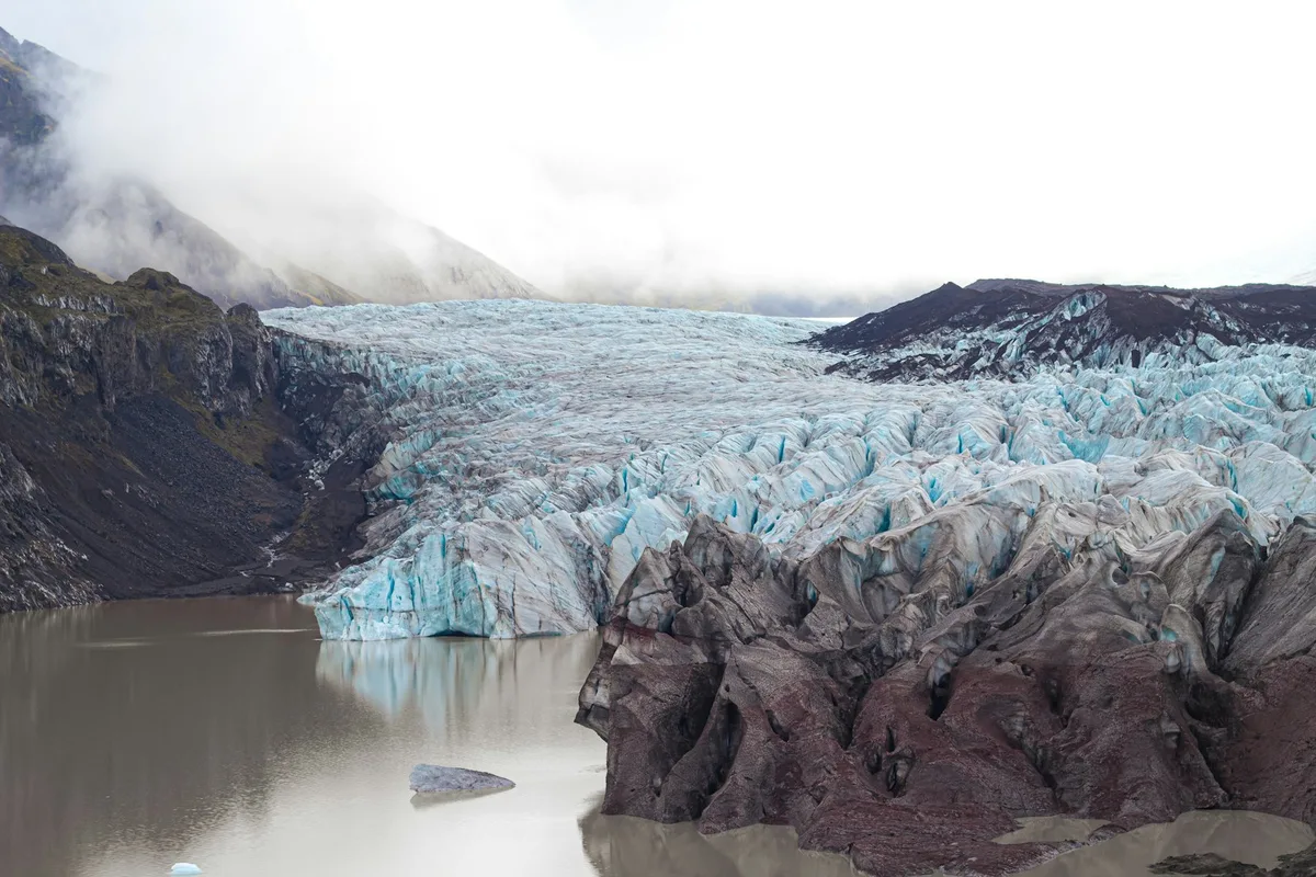
Iceland's largest national park, built around Europe's biggest ice cap, with glacier tongues, ice caves, and the black-sand canyon of Skaftafell offering hiking trails beneath the ice.
 Multi-Day Tours
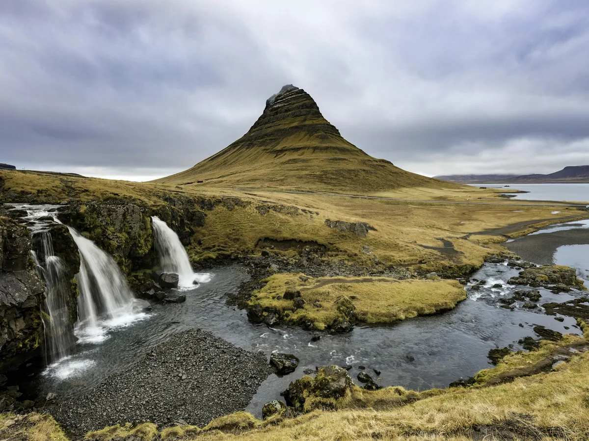
A 10-day loop from the Golden Circle and South Coast to Jokulsarlon, the Eastfjords, Lake Myvatn, Husavik whale-watching, Akureyri, and the Snaefellsnes Peninsula's Kirkjufell Mountain.
 Multi-Day Tours
A 7-day trip pairing Reykjavik with a domestic flight to the remote Eastfjords, a drive south along the Ring Road past Vatnajokull and the South Coast, and a finish through the Golden Circle and Reykjanes Peninsula.
Visitor guide
Vatnajokull National Park is a national park in southeastern and northern Iceland, centred on the Vatnajokull ice cap. Established on 7 June 2008, it covers 14,967 square kilometres, about 14 percent of the country, and Wikipedia describes it as Iceland's largest national park and Europe's second largest by area.
The park includes the former national parks of Skaftafell in the southwest and Jokulsargljufur in the north, with later additions including Lakagigar, Langisjor, Krepputunga and Jokulsarlon. UNESCO inscribed it as a World Heritage Site on 5 July 2019 under the name Vatnajokull National Park, dynamic nature of fire and ice, under natural criterion (viii).
Vatnajokull is described as the largest glacier in Europe, and sources on the page give its surface as 7,700 or 8,100 square kilometres. The ice is typically 400 to 600 m thick and at most 950 m. The ice cap rises above 2,000 m, while its base reaches 300 m below sea level. It conceals mountains, valleys, plateaus and active central volcanoes, of which Barðarbunga is the largest and Grimsvotn the most active. Hvannadalshnjukur, Iceland's highest peak, rises on the volcano Oraefajokull at the glacier's southern edge.
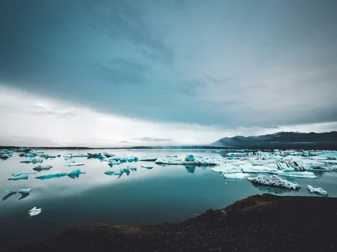
Skaftafell is a vegetated oasis sheltered by the ice. Nearby black sands are largely volcanic ash from Grimsvotn, carried to the coast by glacial floods from the river Skeidara. In the north, Dettifoss is a powerful waterfall at the upper end of the Jokulsargljufur canyon, and Asbyrgi is a horseshoe-curved canyon. The northern highlands include Askja, Kverkfjoll, Snaefell and Herdubreid. Eldgja and Lakagigar are two of the world's great historical fissure eruptions, in 934 and 1783 to 1784. Jokulsarlon, a glacier lagoon known for its icebergs, lies on the park's edge.
Lowland precipitation south of the ice cap ranges from 1,000 to 3,000 mm a year, while the ice cap and mountains can receive 4,000 to 5,000 mm, mostly as snow. Northeast of the ice cap, rainfall falls to 350 to 450 mm, the lowest in Iceland. Wetlands and ranges near the glacier and around Snaefell are important habitats for reindeer and pink-footed geese.
Wikipedia lists visitor centres in each territory. In the north, a centre and campsite at Asbyrgi and a campsite at Vesturdalur; in the east, a centre at Skriduklaustur and the recent Snaefellsstofa; in the south, a centre and campsite at Skaftafell, with information centres at Hofn, Hoffell, Holmur and Skalafell; and in the west, the main park centre at Kirkjubaejarklaustur, run jointly with the local community. The Skaftafell centre is open all year, while Asbyrgi and Skriduklaustur are generally open from May to September. Rangers lead nature walks at Asbyrgi and Skaftafell from mid-June to mid-August.
The park is run through four territories, with visitor centres at Skaftafell, Asbyrgi, Skriduklaustur and Kirkjubaejarklaustur, and most highland areas are inaccessible in winter. The distances are large, and a private guided visit with a driver suits the long journeys between sights.
See every tour and attraction we cover in Iceland.