TorontoOntario · 36 tours
 Niagara FallsOntario · 25 tours
 New York CityNew York · 30 tours
 Las VegasNevada · 8 tours
 San FranciscoCalifornia · 16 tours
 VancouverBritish Columbia · 17 tours
 DubaiUAE · 54 tours
 Abu DhabiUAE · 5 tours
 Buenos AiresArgentina · 23 tours
 AthensGreece · 31 tours
 AucklandNew Zealand · 38 tours
 CancunMexico · 54 tours
No destinations match “”. Try searching all tours instead — that search understands full questions, not just place names.
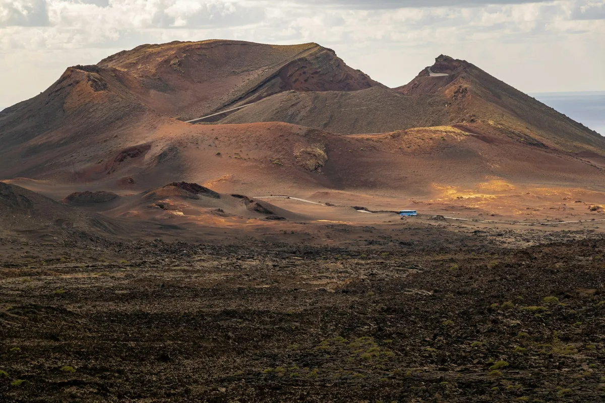
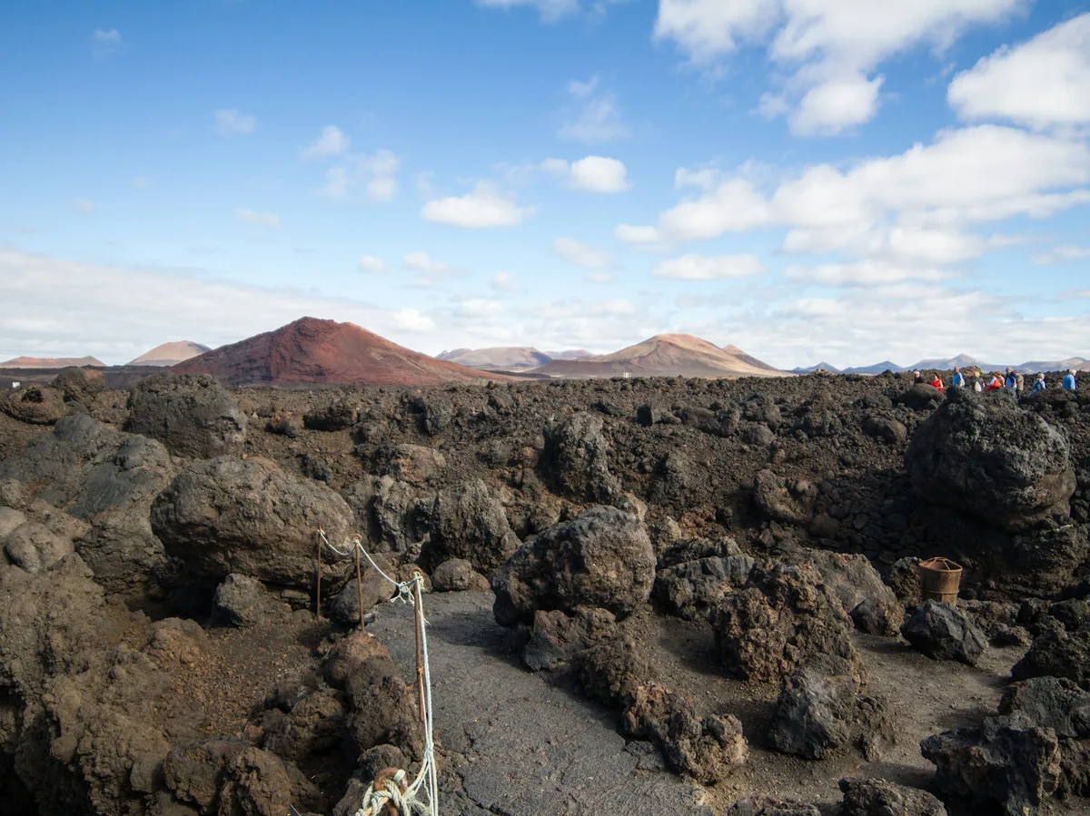
A volcanic landscape on Lanzarote formed by 18th-century eruptions that buried a quarter of the island, now crossed by a single road through fields of solidified lava.
Visitor guide
Timanfaya National Park is a volcanic landscape in the south-west of Lanzarote, in Spain's Canary Islands. It was shaped by a series of eruptions in the 1730s that covered a large part of the island in lava, and it is protected as a national park. Its barren, colourful terrain is among the best-known sights of Lanzarote.
According to Wikipedia, the largest recorded eruptions on Lanzarote took place between 1730 and 1736. They began on 1 September 1730 at the Caldera de los Cuervos volcano, just outside the park, and the last, at Montana Colorada, ended on 16 April 1736. The island article states that the lava covered a quarter of the island's surface, including its most fertile soil and 11 villages, and that the eruptions produced 32 new volcanoes along an 18-kilometre stretch.
The area known as the Montanas del Fuego, or Mountains of Fire, includes about 100 smaller volcanoes. The park's last eruptions are recorded as taking place in 1824, but the 1730-1736 period transformed most of the landscape within its borders.
The park covers about 51 square kilometres across parts of the municipalities of Tinajo and Yaiza. It was established in 1974 and, according to Wikipedia, is the only national park in Spain that is entirely geological. Its soil is entirely volcanic, and the terrain consists of cones, craters, lava fields and ash plains in shades of black, red, ochre and orange.
Because the park is so dry and barren, vegetation is sparse and consists largely of hardy plants and lichens that colonise the lava. The contrast between the dark ground and the blue sky is a defining feature of visits. Away from the park, farmers on Lanzarote grow vines in pits dug into volcanic ash, with low walls that protect the plants from the drying wind.
Volcanic heat is still close to the surface. Wikipedia notes that temperatures range from about 100 to 600 degrees Celsius at a depth of 13 metres. Demonstrations at a visitor area show this by pouring water into a cavity, which almost instantly erupts as steam.
The whole of Lanzarote was designated a UNESCO Biosphere Reserve in 1993, with the national park forming one of its core areas. Access inside Timanfaya is carefully regulated. A public car park serves a coach tour along a road that is otherwise closed to the public, and the footpaths in the park require prior authorisation and a guide, according to Wikipedia.
The park's symbol is the figure El Diablo, a statue by the Lanzarote artist, architect and sculptor Cesar Manrique, who influenced much of the island's visitor architecture and landscape protection.
The experience is dominated by the scenery, so travellers often combine the park with other Lanzarote sights such as the vineyard landscapes. Because access is controlled, a private guided visit helps visitors understand the geology and plan the day, and Voyzo can arrange this with a private vehicle and driver.
See every tour and attraction we cover in Spain.