TorontoOntario · 36 tours
 Niagara FallsOntario · 25 tours
 New York CityNew York · 30 tours
 Las VegasNevada · 8 tours
 San FranciscoCalifornia · 16 tours
 VancouverBritish Columbia · 17 tours
 DubaiUAE · 54 tours
 Abu DhabiUAE · 5 tours
 Buenos AiresArgentina · 23 tours
 AthensGreece · 31 tours
 AucklandNew Zealand · 38 tours
 CancunMexico · 54 tours
No destinations match “”. Try searching all tours instead — that search understands full questions, not just place names.
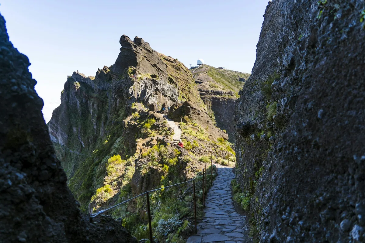
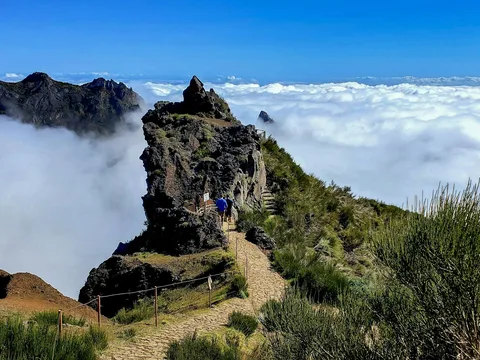
Madeira's highest peak at 1,862 metres, reached only on foot via a rocky trail from Pico do Arieiro or a shorter route from Achada do Teixeira, with panoramic views often above a sea of clouds.
Visitor guide
Pico Ruivo is the highest peak on the island of Madeira, rising to 1,862 metres above sea level according to Visit Madeira (some sources give 1,861 metres). Wikipedia lists it as the third highest peak in Portugal, and it is reached only on foot, either along a ridge trail from Pico do Arieiro or via a shorter route from Achada do Teixeira.
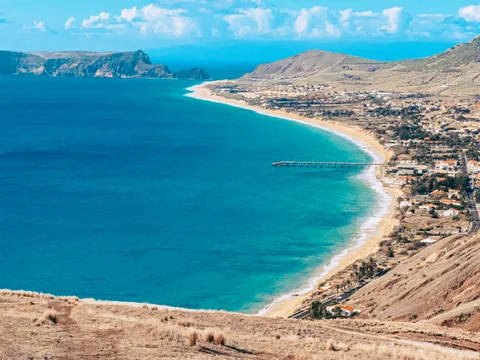
Pico Ruivo lies in the municipality of Santana in the island's central mountain massif. Wikipedia describes views of the green mountains around Curral das Freiras and the Ribeira Grande and São Jorge valleys, and on clear days Porto Santo and the Desertas Islands can be seen. The summit often rises above the clouds, giving visitors the chance to look down on cloud banks, though cloud cover and wind vary greatly. A shelter just north of the peak was renovated in 2019 and offers water, restrooms and meals.
The PR1 route, called the Vereda do Areeiro, starts at Pico do Arieiro at 1,818 metres and covers about 7 kilometres in roughly three and a half hours. It connects Pico das Torres and Pico Ruivo and features volcanic tunnels, steep staircases and dramatic slopes, with a steep final section up to the shelter. The shorter PR1.2, the Vereda do Pico Ruivo, starts at Achada do Teixeira and runs 2.8 kilometres each way, with little altitude change, taking about an hour and a half round trip. Both are rated moderately challenging. PR1.1 descends towards Ilha through laurel forest, and PR1.3 runs west towards Encumeada. Wikipedia notes that PR1.3 was closed as of November 2024, probably because of fire damage, so trail status should be checked.
The upper slopes are surrounded by high-altitude heath, and the central massif has herbaceous and shrubby vegetation. Lower down, the laurel forest of the PR1.1 route is valued for its water retention and biodiversity, and the laurisilva of Madeira was inscribed as a UNESCO World Heritage Site in 1999. Wikipedia says the laurissilva covers about 16 percent of the island. Birds include the Madeira firecrest and the chaffinch, both commonly seen on the PR1.1 trail. The Zino's petrel nests on ledges in the mountains between Pico do Arieiro and Pico Ruivo.
Dug-out caves such as Furna da Lapa da Cadela once sheltered people who harvested heather on the slopes. Heather was used for stakes, firewood or charcoal.
The wider setting is Madeira's Natural Park, which Wikipedia says covers 444 square kilometres and was established in 1982, and the central mountains are also part of the island's protected laurel forest landscape. Madeira has about 1,226 native vascular plant species, of which 66 are endemic to the islands, which helps explain why the high trails are of interest to botanists as well as hikers.
The weather on Madeira's high peaks is unpredictable, and conditions can shift between sun, wind, mist and rain within hours. The shelters along PR1.2 provide protection, and entry arrangements apply on some routes, so check them before going. For a hike from Pico do Arieiro, a private driver can drop off at the start and meet at the end, and a guide helps with pacing, footwear and conditions on the day.
See every tour and attraction we cover in Madeira.