TorontoOntario · 36 tours
 Niagara FallsOntario · 25 tours
 New York CityNew York · 30 tours
 Las VegasNevada · 8 tours
 San FranciscoCalifornia · 16 tours
 VancouverBritish Columbia · 17 tours
 DubaiUAE · 54 tours
 Abu DhabiUAE · 5 tours
 Buenos AiresArgentina · 23 tours
 AthensGreece · 31 tours
 AucklandNew Zealand · 38 tours
 CancunMexico · 54 tours
No destinations match “”. Try searching all tours instead — that search understands full questions, not just place names.
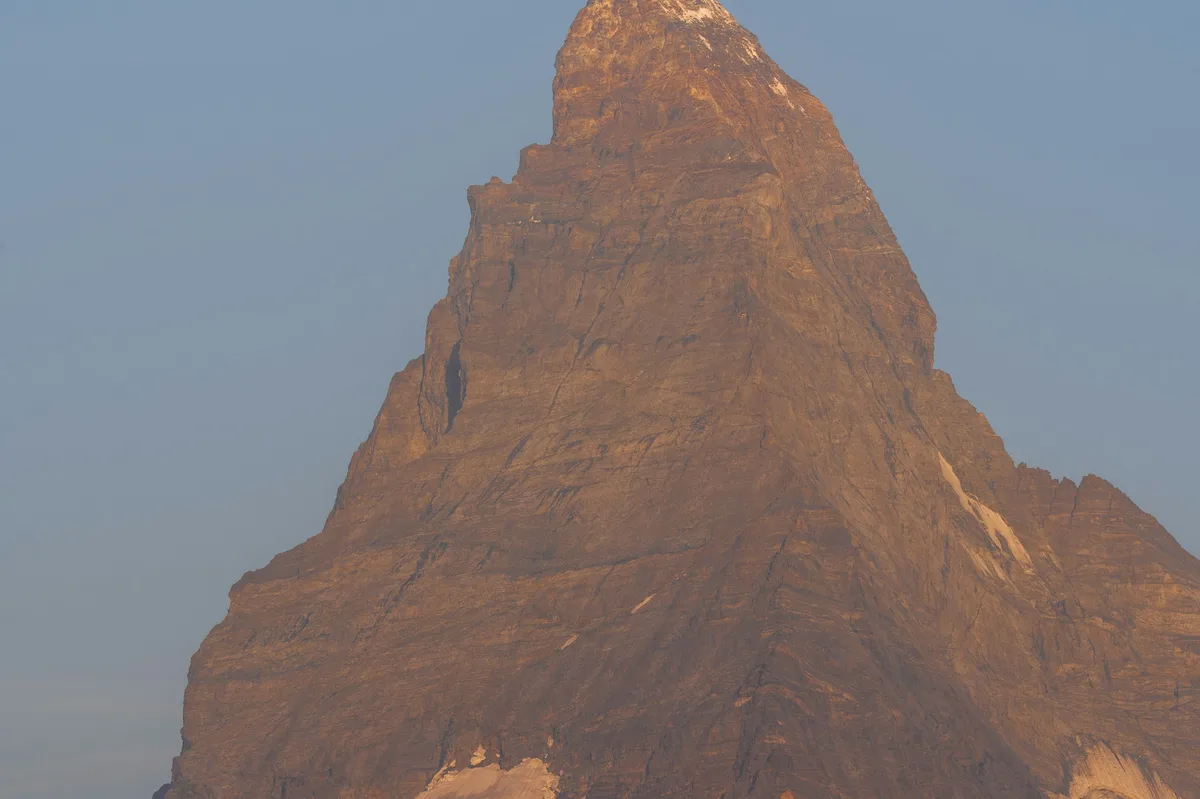
The pyramid-shaped peak that anchors the car-free resort town of Zermatt, visible from the town's streets and from viewpoints reached by cable car above it.
Visitor guide
The Matterhorn is a pyramid-shaped mountain in the Pennine Alps on the border between Switzerland and Italy. Its summit stands at 4,478 metres, and it rises above the Swiss resort village of Zermatt to the northeast and Breuil-Cervinia in Italy to the south.
The name Matterhorn comes from the German Matte, meaning meadow, and Horn, meaning horn. In Italian it is Cervino and in French Cervin. A 1999 GPS survey measured the summit at 4,477.54 metres. The north, east and west faces lie on the Swiss side and the south face on the Italian side, separated by the Hörnli, Furggen, Zmutt and Lion ridges.
According to Wikipedia, the peak is made mainly of gneiss from the Dent Blanche nappe, lying over ophiolites and sedimentary rocks. Erosion by glacial cirques shaped the classic pyramidal form that makes the mountain so recognisable.
Edward Whymper's party reached the summit on 14 July 1865 via the Hörnli ridge. On the descent, four of the seven climbers died in a fall. Jean-Antoine Carrel reached the summit from the Italian side three days later. The event is among the best-known episodes in the history of mountaineering. By the late 1980s an estimated 500 or more people had died attempting the summit, which shows how serious a technical climb it remains.
The Hörnli Hut, at 3,260 metres, is the start of the normal climbing route via the Hörnli ridge and is accessible from Schwarzsee. Most visitors do not climb, though. Zermatt is the base for viewing the peak, and the Gornergrat railway, inaugurated in 1898, reaches about 3,100 metres. The Klein Matterhorn cable car, at 3,883 metres, is described by Wikipedia as the highest transportation system in Europe.
The mountain anchors the car-free resort of Zermatt, where the peak is visible from the village streets and from viewpoints reached by railway and cable car. Because the summit often clouds over, weather and season strongly affect what you see.
English newspapers blamed the climbers harshly, and a German paper accused Whymper of cutting the rope between Douglas and Taugwalder to save himself. Whymper's book Scrambles Amongst the Alps (1871) became a worldwide bestseller and helped start mountain tourism. Emil Cardinaux's 1908 Zermatt poster is often considered the first modern poster, and the mountain has appeared on Toblerone bars since 1960.
The north face is rated TD/V and takes about 14 hours from the Hörnli Hut. It is described as among the six most difficult faces in the Alps. The usual Hörnli ridge route takes about 6 hours from the hut, with fixed ropes on parts of it, and climbers typically start before dawn because afternoon clouds and storms regularly arrive. The Hörnli Hut was renewed in 2015, when it became the first mountain shelter in Europe to limit beds due to overcrowding.
Zermatt lies at about 1,620 metres at the upper end of the Mattertal in the canton of Valais. Wikipedia says the whole town is a combustion-engine-free zone, to avoid air pollution that could obscure the Matterhorn view, so almost all vehicles are battery-driven and horse-drawn carriages are also available. Until the mid-19th century it was mainly an agricultural community, and the 1865 ascent triggered a rush of tourism. The Kirchbrücke is one of the most popular spots to photograph the mountain.
The Gornergrat railway, a rack line and Europe's highest open-air railway, takes about 29 minutes to reach a summit of 3,089 metres, according to Wikipedia, and the Matterhorn Museum tells the story of the first ascent.
Visitors to the Matterhorn region typically combine town time in Zermatt with a railway or cable-car ascent. A private guide can help plan around weather, and a private vehicle and driver can handle transfers to the valley station.
See every tour and attraction we cover in Switzerland.