TorontoOntario · 36 tours
 Niagara FallsOntario · 25 tours
 New York CityNew York · 30 tours
 Las VegasNevada · 8 tours
 San FranciscoCalifornia · 16 tours
 VancouverBritish Columbia · 17 tours
 DubaiUAE · 54 tours
 Abu DhabiUAE · 5 tours
 Buenos AiresArgentina · 23 tours
 AthensGreece · 31 tours
 AucklandNew Zealand · 38 tours
 CancunMexico · 54 tours
No destinations match “”. Try searching all tours instead — that search understands full questions, not just place names.
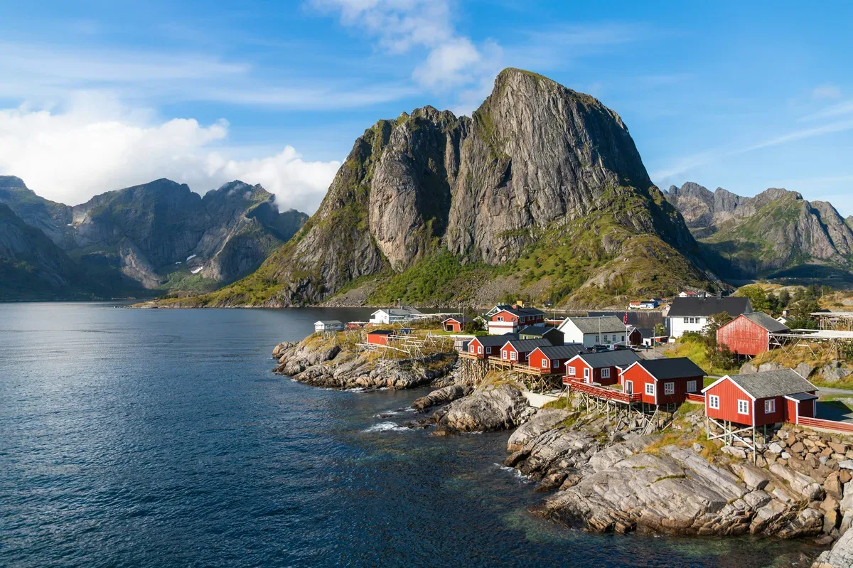
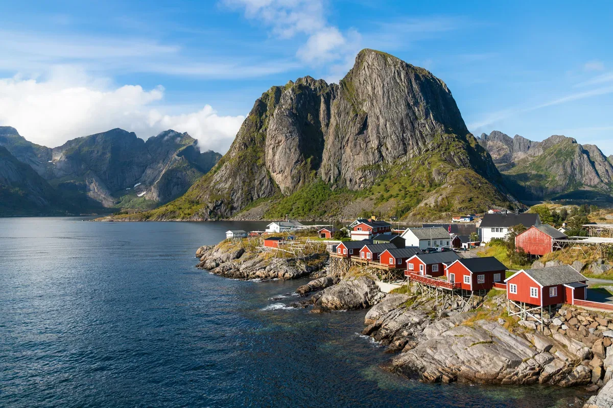
A chain of dramatic peaks rising straight from the sea, dotted with red fishing cabins and villages like Hamnøy and Reine.
Visitor guide
The Lofoten Islands are an archipelago and traditional district in Nordland county, northern Norway, lying between the 68th and 69th parallels north. Steep mountains rise almost straight from the sea, and old fishing villages such as Reine and Hamnøy sit in the shelter of their slopes. Despite the latitude, the islands have a notably mild climate.
Lofoten covers about 1,227 square kilometres of land and has roughly 24,500 residents, spread across the municipalities of Vågan, Vestvågøy, Flakstad, Moskenes, Værøy and Røst. The main islands, from north to south, are the southern tip of Hinnøya, the southern part of Austvågøya, Gimsøya, Vestvågøya, Flakstadøya and Moskenesøya, with Værøy and Røst as small, more isolated islands further south. Svolvær and Leknes are the two towns. The open Vestfjorden separates the archipelago from the mainland, and Vesterålen lies to the north.
Seen from the sea or from high ground, the chain looks like a closed wall of peaks, an impression often called the Lofoten wall. The highest summit is Higravstinden on Austvågøya, at roughly 1,150 metres (sources give figures from about 1,146 to 1,161 metres). Geologically, Lofoten is a horst ridge of bedrock belonging to the Western Gneiss Region. In western Lofoten the tidal eddies of the Moskstraumen give the word maelstrom its root.
Wikipedia describes winter temperatures as extremely mild for the latitude, possibly the largest positive temperature anomaly in the world relative to latitude. The cause is the warm Norwegian Sea, fed by the North Atlantic and Norwegian currents, together with mild Atlantic air. Strong winds, snow and sleet are still common in late autumn and winter.
The sun stays above the horizon in Svolvær from 25 May to 17 July, and the polar night there runs from 4 December to 7 January. Leknes has similar dates. Winter visitors come for the aurora and Arctic scenery, and the islands are reported to draw around one million visitors a year as of 2017.
Evidence of human presence on the islands goes back at least 11,000 years, with Iron Age farming traced to around 250 BC. Vågan, near present-day Kabelvåg, is described as the first known town formation in northern Norway. For over a thousand years Lofoten has been a centre of cod fishing, especially in winter, when cod migrate from the Barents Sea to spawn. Bergen became the export hub for cod to Europe, particularly under the Hanseatic League, and the red fishermen's cabins that dot the shoreline are a legacy of this trade.
Near Borg on Vestvågøya, the Lofotr Viking Museum has a reconstructed longhouse of 83 metres, described as the largest known. In March 1941 British Commandos raided the islands in Operation Claymore, followed by Operation Anklet in December.
Henningsvær, on Austvågøya, is a centre for rock climbing, and its football pitch sits on a rocky islet. Svolvær is the larger town and a Hurtigruten port, and houses the North Norwegian Art Centre. Reine and Hamnøy lie on Moskenesøya, where the mountaineering is serious and remote. Unstad is a well-known surf spot, and a marked cycling route runs from Å in the south to beyond Fiskebøl in the north.
The Røst Reef, west of Røst, is described as the world's largest deep-water coral reef, and the islands' waters are reported to be a breeding ground for around 70 percent of the fish caught in the Norwegian and Barents seas. Otters are common, elk live on the larger islands, and sea eagles, cormorants and puffins nest here. The islands hold what the article calls the largest seabird colony in mainland Europe. Woodland consists of downy birch and rowan, with no native conifer forests.
The E10 road links the larger islands by bridges and undersea tunnels, and the Lofast road to the mainland opened on 1 December 2007. There are no trains, but ferries serve Moskenes, Værøy and Røst, and airports operate at Leknes and Svolvær. A private tour with a driver is a practical way to cover the long distances between villages.
See every tour and attraction we cover in Norway.