TorontoOntario · 36 tours
 Niagara FallsOntario · 25 tours
 New York CityNew York · 30 tours
 Las VegasNevada · 8 tours
 San FranciscoCalifornia · 16 tours
 VancouverBritish Columbia · 17 tours
 DubaiUAE · 54 tours
 Abu DhabiUAE · 5 tours
 Buenos AiresArgentina · 23 tours
 AthensGreece · 31 tours
 AucklandNew Zealand · 38 tours
 CancunMexico · 54 tours
No destinations match “”. Try searching all tours instead — that search understands full questions, not just place names.
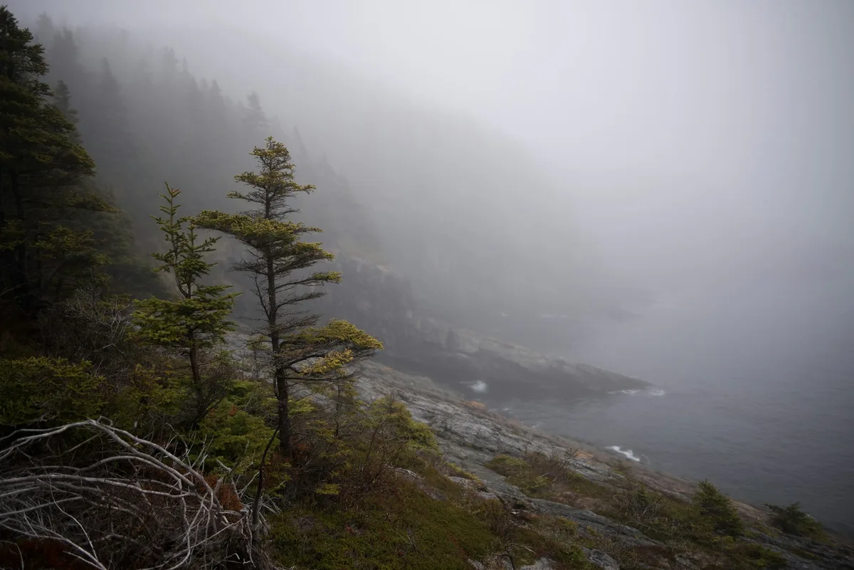
A long-distance coastal hiking trail network stretching over 300 km along Newfoundland's Avalon Peninsula, with sections near St. John's passing sea cliffs, fishing villages, and whale- and iceberg-watching points.
Visitor guide
The East Coast Trail is a path network along the Avalon Peninsula coast of Newfoundland, running from Topsail Beach in Conception Bay South around Cape St. Francis, through St. John's, and south to Cappahayden. Wikipedia gives about 336 km of developed trail in 25 linked paths past more than 30 communities, built and maintained largely by volunteers of the East Coast Trail Association.
Volunteers began building the trail in 1994 using existing traditional footpaths, and had about 25 km done by year's end. The East Coast Trail Association was incorporated in 1995 and later became a registered charity. By 1996 about 125 km had been completed, and Wikipedia reports that 212 km, from Fort Amherst to Cappahayden, formally opened in September 2001, while the Association's own history page marks the 220th km as officially opened that year. National Geographic named it one of its best adventure destinations in 2012. A planned extension toward Trepassey, passing Cape Race and Mistaken Point, is described as not yet developed, and the Association's own pages are the place to check the current extent.
The route follows sea cliffs, headlands, coves and fjord-like bays, with boreal forest, heath and bog inland of the edge. It passes historic coastal outports, eight historic lighthouses, and the national historic sites of Signal Hill and Cape Spear, the latter described as the easternmost point in North America excluding Greenland, as well as the Ferryland area. Highlights named by Wikipedia include The Spout, a natural geyser-like blowhole that volunteers restored in the 1990s, and the Cobblers and Sugarloaf formations. Seasonal wildlife includes whales, seabirds and, in some years, icebergs; moose are common on the Avalon, especially at dawn and dusk. Witless Bay Ecological Reserve, nearby, is noted for its Atlantic puffin colony.
The Association rates each path as Easy, Moderate, Difficult or Strenuous. Easy paths run roughly 2 to 7 km with elevation changes up to about 25 m and bridges, boardwalks and steps; Moderate paths are about 4 to 11 km with changes up to 75 m; Difficult paths are 9 to 17 km with up to 150 m of climbing and more rugged wilderness conditions; Strenuous paths exceed 150 m of elevation change with minimal trail structures. Paths run between communities and do not loop, and distances are one way. Black and white waymarker posts guide you across open rock and barrens.
The Association gives April to November as the best season, since the trail is most likely free of snow and ice, and says no maintenance or condition updates happen from December to March. Fog can arrive without warning and forecasts often miss the mark. It stresses sturdy hiking footwear, layers, water, navigation aids on difficult paths, and telling someone your route, and notes that cell coverage is intermittent. Storms can leave fallen trees and erosion on paths, and the Association has issued safety notices during dry, wildfire-prone periods; check its trail conditions page and the provincial fire information before you go. Cliff edges are exposed and unfenced on many sections.
Because paths are one-way, logistics are the main puzzle. On a Voyzo private tour, a private driver can take you door to door to one trailhead and meet you at the other end, so you can walk a single path without retracing your steps; which path suits your group is something to settle when you plan.
Several paths start inside or close to St. John's, including routes near Fort Amherst and Cape Spear, so a short coastal walk can be combined with a city visit. Public transit reaches some access points, and La Manche Provincial Park lies near the trail further south.
See every tour and attraction we cover in St. John's.