TorontoOntario · 36 tours
 Niagara FallsOntario · 25 tours
 New York CityNew York · 30 tours
 Las VegasNevada · 8 tours
 San FranciscoCalifornia · 16 tours
 VancouverBritish Columbia · 17 tours
 DubaiUAE · 54 tours
 Abu DhabiUAE · 5 tours
 Buenos AiresArgentina · 23 tours
 AthensGreece · 31 tours
 AucklandNew Zealand · 38 tours
 CancunMexico · 54 tours
No destinations match “”. Try searching all tours instead — that search understands full questions, not just place names.
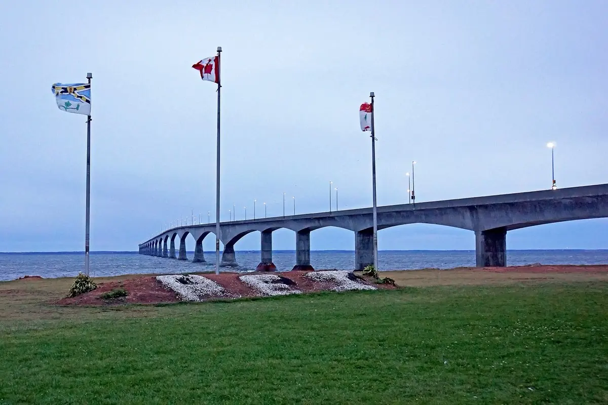
At nearly 13 km, the longest bridge in the world over ice-covered water, linking PEI to New Brunswick.
Visitor guide
The Confederation Bridge carries the Trans-Canada Highway across the Northumberland Strait, linking Borden-Carleton, Prince Edward Island, with Cape Jourimain, New Brunswick. At about 12.9 kilometres it is Canada's longest bridge and is widely described as the longest bridge over ice-covered water.
For generations the crossing relied on ferries. Wikipedia says the Abegweit Passage service ran from steamships to iceboats and then, from the 1910s, a railcar ferry between Borden, PEI, and Cape Tormentine, New Brunswick. It was operated by Canadian Government Railways, then Canadian National, then CN Marine, and from 1986 by Marine Atlantic; the ferry terminals were removed in 1997. Proposals for a fixed link go back to the 1870s, and a 1965 tunnel-causeway-bridge scheme was abandoned in 1969. Wikipedia reports that tidal analysis by the Canadian Hydrographic Service found a causeway would create currents strong enough to make closing the passage impractical.
The bridge replaced the ferry service that had been a federal commitment since Prince Edward Island joined Confederation in 1873. Islanders voted on a fixed link in a plebiscite on January 18, 1988; Wikipedia reports roughly 59 to 60 percent in favour, and that opponents raised ecological and lifestyle concerns. A 1993 constitutional amendment allowed tolls and private operation of a fixed crossing. Construction began on November 1, 1993, and the bridge opened to traffic on May 31, 1997. Reported costs vary by source, from several hundred million to about C$1.3 billion, so the figure should be treated as approximate.
French engineer Jean Muller, who specialized in match-cast concrete bridges, designed it as a post-tensioned concrete box girder using balanced cantilever spans. The curved deck is about 11 metres wide and about 40 metres above the water, with a navigation span of about 60 metres of clearance. Pier counts vary by source: Wikipedia lists 62 piers, 44 of them main piers spaced 250 metres apart. Components were built on land at a staging yard at Amherst Head and a facility at Bayfield, New Brunswick, then set in place by the Dutch heavy-lift catamaran Svanen, which had previously worked on Denmark's Great Belt Bridge. Large pieces were moved on crawler transports that workers nicknamed lobsters. Wikipedia says more than 5,000 workers took part and that the main structure was completed in November 1996.
Each pier has a conical ice shield at the waterline, which forces sea ice to ride up and break rather than pushing on the structure. Sources say it was designed for a 100-year life. Concrete barriers along the deck also act as wind barriers.
The naming committee's choice, Abegweit Crossing, was overruled, and the federal government chose Confederation Bridge in 1996. In 2022 the PEI legislature unanimously backed the alternate name Epekwitk Crossing, after the Mi'kmaq name for the island; this was still pending federal approval when the sources were written.
The bridge is operated by Strait Crossing Bridge Limited under a concession that Wikipedia says runs until 2032, when ownership reverts to the Government of Canada. The speed limit is 80 km/h, subject to weather, and the crossing takes about 10 minutes under normal conditions, according to the operator. A toll applies only when leaving PEI; the toll has changed over time, so check the operator for current rates. Pedestrians and cyclists cannot cross on their own, but a shuttle service is available, so check with the operator. Wind and weather can restrict some vehicles.
There is a visitor area near the PEI end at Borden-Carleton, but check the operator for its current services.
On a private transfer or tour, you can cross in your own vehicle with your driver, and take photographs from a safe stop on the island side.
See every tour and attraction we cover in Charlottetown.