TorontoOntario · 36 tours
 Niagara FallsOntario · 25 tours
 New York CityNew York · 30 tours
 Las VegasNevada · 8 tours
 San FranciscoCalifornia · 16 tours
 VancouverBritish Columbia · 17 tours
 DubaiUAE · 54 tours
 Abu DhabiUAE · 5 tours
 Buenos AiresArgentina · 23 tours
 AthensGreece · 31 tours
 AucklandNew Zealand · 38 tours
 CancunMexico · 54 tours
No destinations match “”. Try searching all tours instead — that search understands full questions, not just place names.
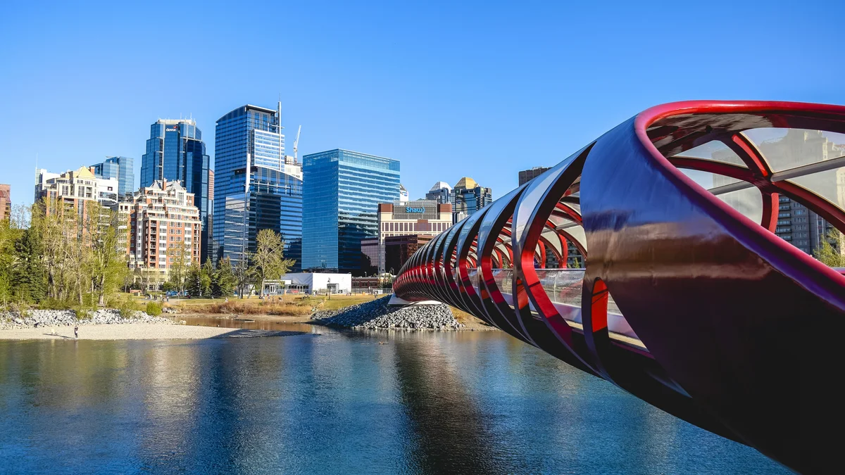
An extensive paved pathway system tracing the Bow River through the heart of Calgary, linking downtown parks, the Peace Bridge, and neighborhoods along the water. It's one of North America's most extensive urban pathway networks, popular for walking, cycling, and taking in views of the skyline and, further out, the Rockies.
Visitor guide
The Bow River pathway is a paved network of pedestrian and cycling routes running along both banks of the Bow River through Calgary. Wikipedia gives its length as about 48 kilometres, running from the Valley Ridge community to Fish Creek Provincial Park, though sources differ slightly on the end points. It is the spine of the city's wider pathway system and links many of Calgary's best-known riverside places.
Construction began in 1975 as a project to mark Calgary's centennial, and the first section was dedicated on June 25, 1977. The City of Calgary and the Devonian Group of Charitable Foundations are credited as funders; one source also names the Province of Alberta, so accounts differ on that point. The earlier dirt-path claim attributed to a trail association could not be verified, so it is left out here.
The path follows the river west to east and then north to south. Along the way it passes or links to roughly thirty recreation areas listed on Wikipedia, which cites a 1990 book on Calgary parks and pathways for the list. Among them are Bowness Park, Edworthy Park, Shaw Millennium Park, Prince's Island Park, Fort Calgary, the Calgary Zoo, the Inglewood Bird Sanctuary and Fish Creek Provincial Park. Further connections lead to pathways along the Elbow River, Glenmore Reservoir and Nose Creek.
A few structures stand out. The Harry Boothman Bridge carries the pathway across the river in Edworthy Park, and a two-level bridge near Downtown West End puts C-Train light rail on top and the pathway below. A pedestrian bridge leads to Prince's Island Park. Because the Bow runs through the heart of the city, the route offers skyline views downtown and quieter, more wooded stretches at either end.
Wikipedia lists walking, cycling, jogging, rollerblading and skateboarding as uses. The pathway is a shared space, so keep to the right, pass with care and give pedestrians priority; check the City of Calgary for current etiquette, detours and any flood or maintenance closures, which can affect sections of riverside pathways.
Distance is the main thing to plan for. At about 48 kilometres end to end, nobody sees it all in one outing, so most visitors pick a stretch. Downtown, the portion through Prince's Island and past Fort Calgary is compact and easy to combine with sights nearby, while the wetland and bird-watching stretches toward Inglewood and Fish Creek suit a slower day. The Wikipedia article is tagged as needing more citations, so treat its finer details, such as the park list, as indicative and verify with the City before relying on a specific connection.
The pathway works well on a private tour because a driver can drop you at one point and collect you at another, which solves the problem of walking one-way along a long linear route. A private Voyzo tour with a private vehicle and door-to-door pickup can be built around this idea: for example, a downtown stroll, then a ride to a different stretch. We do not set fixed itineraries here, so ask when you request a quote.
See every tour and attraction we cover in Calgary.