TorontoOntario · 36 tours
 Niagara FallsOntario · 25 tours
 New York CityNew York · 30 tours
 Las VegasNevada · 8 tours
 San FranciscoCalifornia · 16 tours
 VancouverBritish Columbia · 17 tours
 DubaiUAE · 54 tours
 Abu DhabiUAE · 5 tours
 Buenos AiresArgentina · 23 tours
 AthensGreece · 31 tours
 AucklandNew Zealand · 38 tours
 CancunMexico · 54 tours
No destinations match “”. Try searching all tours instead — that search understands full questions, not just place names.
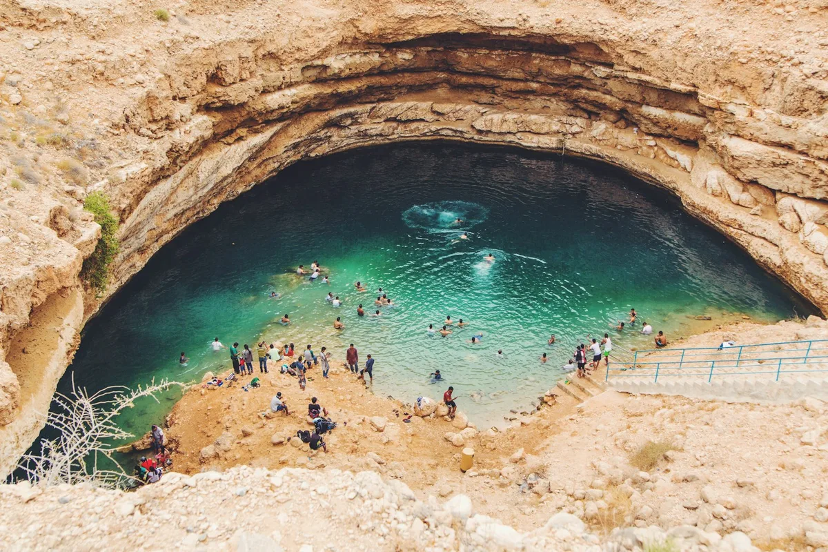
A collapsed limestone crater near Muscat filled with turquoise, faintly brackish water, reached by a short stairway down from the parking area.
Visitor guide
The Bimmah Sinkhole, known in Arabic as Hawiyat Najm, is a water-filled limestone sinkhole in the east of Muscat Governorate, Oman. Its turquoise lake sits inside a fenced municipal park beside the coastal highway to Sur, about 600 metres from the sea.
Wikipedia describes the lake as about 50 by 70 metres across and roughly 20 metres deep, although the same page also quotes a far greater depth from a source it flags as possibly unreliable, so depth is best treated as approximate. The feature is explained as a sinkhole: limestone below the surface dissolved through contact with water, and the thin surface layer above collapsed. Travel accounts say the water is a mix of fresh and salt, which fits the site's closeness to the coast, although claims of an underground tunnel to the sea are not backed by sources read here.
The sinkhole lies between the coastal towns of Dibab and Bimmah, a few kilometres before Tiwi, and is also called the Dibab Sinkhole in some sources. It sits close to the boundary with the Ash Sharqiyah region, just off the highway to Sur.
The Arabic name Hawiyat Najm is commonly translated as the deep well of the falling star. Locals long believed that a meteorite fell here and created the depression, a story that explains the name but is not supported by geology, which points to a sinkhole. Another local name, Bayt al Afreet, meaning house of the demon, is reported in travel writing, again as folklore.
To protect the site, the local municipality developed Hawiyat Najm Park around it. Wikipedia says the park is fenced, has toilet facilities, and includes a stairway leading down to the water. Visitors commonly swim in the lake, and travel accounts describe an entrance sign explaining how the sinkhole formed.
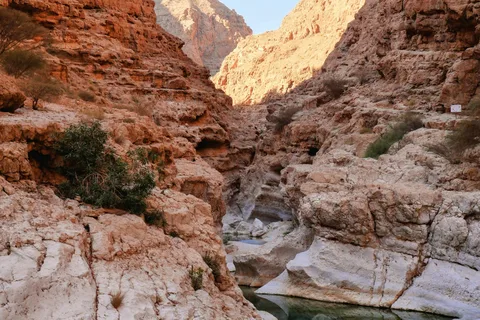
The sinkhole belongs to a coastline backed by the Hajar Mountains, a range that Wikipedia says extends about 700 kilometres through the United Arab Emirates and Oman, from the Musandam Peninsula to Oman's east coast, and lies roughly 50 to 100 kilometres inland from the Gulf of Oman in its northern parts. The range is built from sequences of carbonate, clastic and evaporite rocks and also contains the Semail Ophiolite, a slab of oceanic crust and upper mantle thrust onto the continent during the Cretaceous and often described as among the most complete on Earth. Wikipedia notes that the timing of the uplift that created today's topography is still debated, placed somewhere between the late Eocene and the Miocene. The carbonate rocks of this region are the kind of soluble stone in which sinkholes can form, though this article does not say which specific rock formation underlies Hawiyat Najm.
Muscat Governorate has six wilayats, or districts, one of which is Qurayyat on the south-eastern coast. Wikipedia describes Qurayyat as a small fishing town about 83 kilometres south-east of Muscat, near Sur, with a coast of high humidity in summer and the Black Mountain, Al-Jabal al-Aswad, in its interior. Archaeological finds at Khor al-Milh, a salt estuary a few kilometres from the town, are linked by the same article to the third and fourth millennia BC, and the Portuguese in the sixteenth century included the area in their chain of coastal fortifications controlling the Gulf of Oman. Qurayyat Fort, built by Said bin Khalfan al-Busaidi roughly 200 years ago according to Wikipedia, now serves as a museum of local pottery and weaponry. These details concern the wider district and are included for context; the sinkhole's exact administrative position is not stated in the sources read.
The sinkhole is a short stop rather than a full excursion, and it is usually combined with nearby coastal highlights, notably Wadi Shab and Wadi Tiwi, which lie a short distance to the south. A private tour with a driver makes this combination simple, since the stops lie along the same coastal road.
See every tour and attraction we cover in Oman.