TorontoOntario · 36 tours
 Niagara FallsOntario · 25 tours
 New York CityNew York · 30 tours
 Las VegasNevada · 8 tours
 San FranciscoCalifornia · 16 tours
 VancouverBritish Columbia · 17 tours
 DubaiUAE · 54 tours
 Abu DhabiUAE · 5 tours
 Buenos AiresArgentina · 23 tours
 AthensGreece · 31 tours
 AucklandNew Zealand · 38 tours
 CancunMexico · 54 tours
No destinations match “”. Try searching all tours instead — that search understands full questions, not just place names.
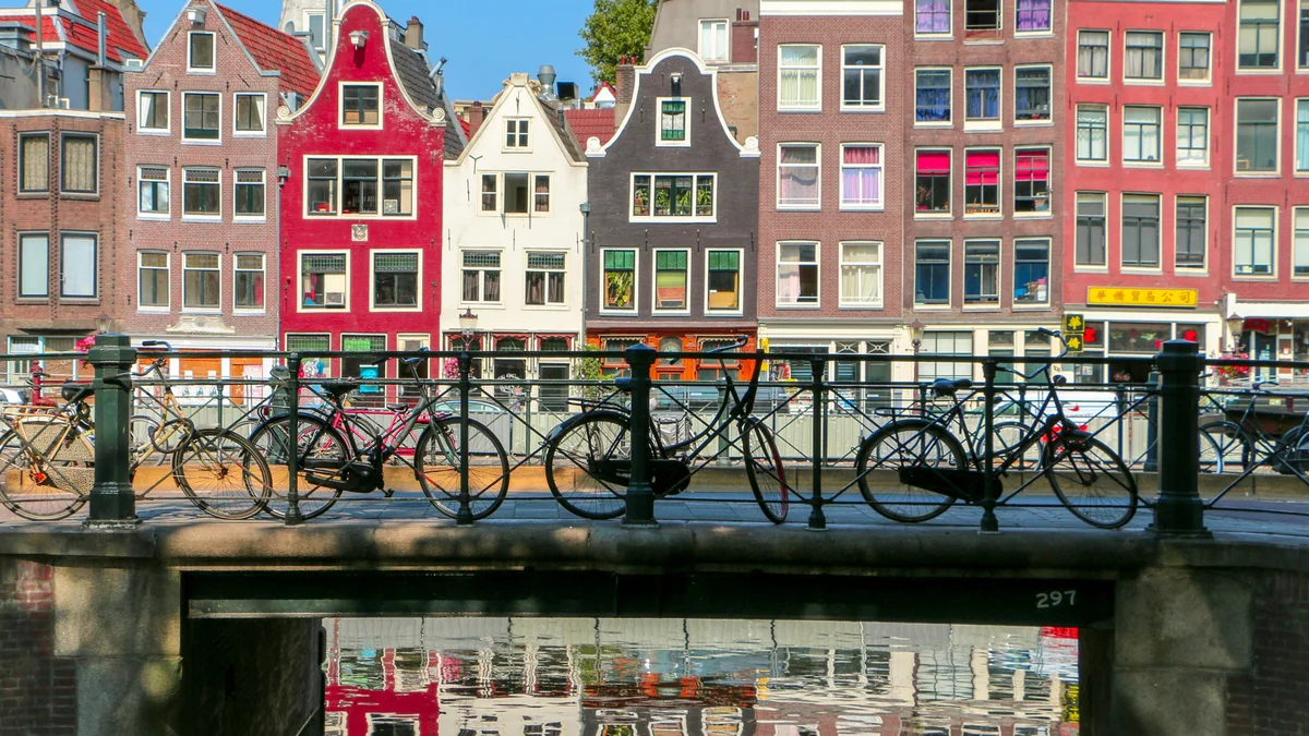
The Amsterdam Canal Ring is the 17th-century belt of concentric canals — Herengracht, Keizersgracht, and Prinsengracht — that were dug during the city's Golden Age to expand and drain the growing merchant city. Lined with more than 1,500 gabled canal houses and crossed by hundreds of bridges, the district became a UNESCO World Heritage Site in 2010 for its exceptional urban planning. A boat tour or a slow bike ride along the water is the classic way to take it in.
Visitor guide
The Amsterdam Canal Ring, or Grachtengordel, is the belt of concentric 17th-century canals around the historic centre of Amsterdam, in the Netherlands. Built during the Dutch Golden Age, it was listed as a UNESCO World Heritage Site in 2010.
Three main canals form the ring: the Herengracht, the Keizersgracht and the Prinsengracht. They were dug in the 17th century as concentric belts around the older city, with the Singelgracht serving defence and water management on the outside. According to Wikipedia, the plan called for four concentric half-circles of canals ending at the IJ Bay, plus radial connecting canals, parallel canals in the Jordaan for goods such as beer, and more than 100 bridges.
Construction began in the early 1600s as immigration rose. It moved from west to east, with the north-western sector starting in 1613 and largely finished around 1625. The southern sector began after 1664 and progressed slowly because of an economic depression, and the eastern part was not built for a long time.
The Herengracht, called the Patricians' or Lords' Canal, was the first of the three and has its most fashionable stretch in the Golden Bend. The Keizersgracht, the Emperor's Canal, is the widest of the three. The Prinsengracht, the Prince's Canal, is the longest of the main canals and is named after the Prince of Orange, with the Jordaan lying to its west. The Singel, now the innermost canal, served as a moat from 1480 to 1585.
Along the Brouwersgracht, ships returning from Asia unloaded spices and silks, and many warehouses stood there that are now apartments. Officials of the Dutch East India Company lived along Brouwersgracht and Kloveniersburgwal.
The 17th-century canal ring, including the Jordaan, was listed by UNESCO in 2010 under reference 1349 for criteria i, ii and iv. The listed area is about 198 hectares, with a buffer zone of about 482 hectares. Wikipedia counts more than 100 kilometres of canals in Amsterdam as a whole, about 90 islands and roughly 1,500 bridges, with about 1,550 monumental buildings beside the main canals.
The canals are still used for tourism, recreation and houseboats, while walking, light rail, metro and cycling are the main ways to get around the city. Between 12,000 and 15,000 bicycles are pulled from the canals each year, according to Wikipedia. The narrow, tall canal houses with gables are one of the city's most recognisable sights. Many are now homes, offices and hotels, and the monumental buildings along the main canals number about 1,550 according to Wikipedia, which is why the ring is protected as an ensemble and not only as individual landmarks.
A boat on the water or a walk along the canal banks are the classic ways to see the ring. A private tour with a driver can pair a canal cruise with nearby sights such as the Anne Frank House on the Prinsengracht, and a guide can explain how the plan was laid out.
See every tour and attraction we cover in Amsterdam.